



Among the Grandeur of the Menhirs, Recent Geophysical Discoveries, the Saint-Michel Tumulus, and the Museum of Prehistory
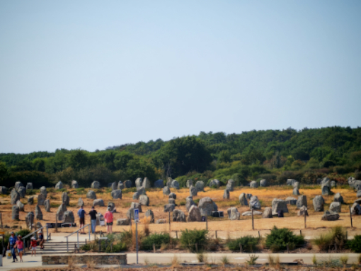
At long last… Carnac!
We chose the pleasant town of Vannes as our base, and the 25-minute drive connecting us to the heart of Morbihan is delightful, winding through rolling hills, woodlands, and traditional houses with dark slate roofs. As soon as we arrive in Carnac, we instantly realize why it is considered one of the most iconic monumental landscapes in the world. The sheer scale of the site leaves you breathless: a true stone architecture engineered across kilometers of land!
The Alignments: Anatomy of a Giant
The numbers of Carnac speak for themselves: approximately 2,730 recorded menhirs to date, stretching across roughly 4 kilometers and divided into its famous sectors (Le Ménec, Kermario, Kerlescan, and Le Petit Ménec).
The alignments are not continuous; they are interrupted by three main gaps and appear to follow a precise spatial layout: the stones are arranged in decreasing order, from the tallest (located to the west) to the shortest (toward the east). Immediately before the first group and within these gaps, one notices menhirs positioned out of alignment, forming semi-circular or rectangular structures. Most of the menhirs were quarried directly from the bedrock granite outcroppings upon which they still stand today.
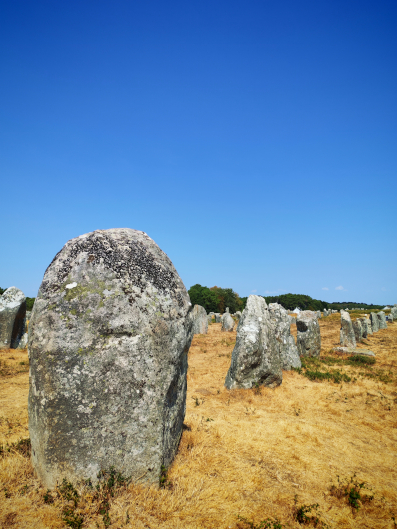
Considering that local granite has a density of 2.7 metric tons per cubic meter, quarrying, lifting, and positioning these blocks required an organized, skilled society driven by a shared vision—further proof that six to seven thousand years ago, this region was inhabited by a population that was not only numerous, but highly specialized and complex.
Upon arriving at the visitor center—a beautiful building featuring a bookshop, a temporary exhibition space, and an elevated first-floor viewing platform to admire the vastness of the first sector—we join a tour with a guide who is as engaging as she is knowledgeable, allowing us to walk right inside the site itself. Up close, the monoliths are striking in both size and placement. Yet, one detail is even more astonishing: while the surface of the stones today is eroded by weathering (with losses of several millimeters in depth), protected or subterranean finds reveal that all the menhirs were originally engraved. Just imagining such a vast expanse of carved stones (perhaps similar to those seen inside Gavrinis) is mind-boggling!
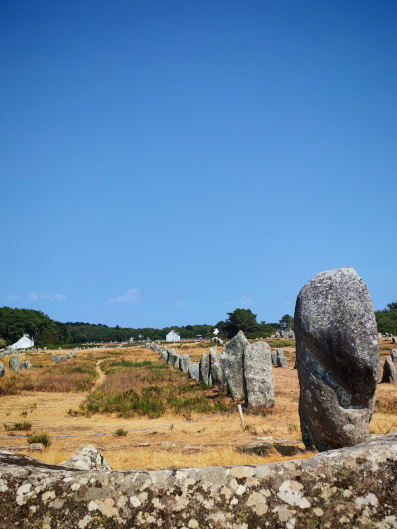
As we walk among these monoliths, our guide points out that several are marked with a small orange dot. The reason? Around a century ago, in 1920, archaeologists re-erected about 20% of the stones found fallen on the ground, placing them according to the prevailing theories of the era. For scientific transparency, these “re-erected” stones were marked with an orange dot or circle, allowing subsequent scholars (and visitors) to distinguish them from those remaining in their original in situ positions.
Beneath the Surface: The Scientific & Geophysical Breakthrough (2026)
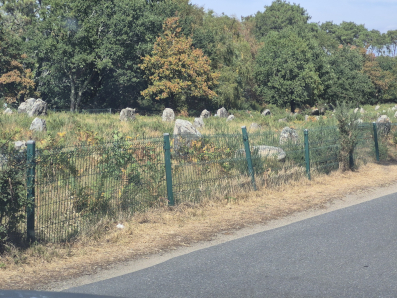
While strolling among the blocks, our guide mentioned a cutting-edge geophysical study published in February 2026 in the journal Archaeological Prospection, conducted by a research team led by Guillaume Bruniaux, Vivien Mathé, Olivier Agogué, and Vincent Ard. As soon as we returned to our accommodation, we read it, and we are delighted to share it with you here because, in its methodology and findings, it represents a genuine breakthrough.
The researchers applied an ultra-high-resolution, non-invasive protocol (combining magnetometry, ground-penetrating radar [GPR], and electrical resistivity tomography [ERT]) across the unexcavated terrain between the Kerlescan alignments and the Manio mound. In doing so, they respected the strict excavation limits designed to protect this site, likely in the hope that non-invasive technologies would eventually deliver major scientific advancements.
The mapping unveiled a vast array of subsurface anomalies completely invisible on the ground surface. They identified biches (stone socket pits)—meaning they located the exact underground footprints of hundreds of menhirs removed or destroyed over the centuries! Hundreds… Furthermore, the geophysical data mapped associated charcoal/cooking hearths (cooking pits) and buried structural enclosures. The analysis proves that the Carnac complex was not a series of isolated alignments, but a much denser, interconnected, and continuous landscape than indicated by the standing stones visible today. A spatial continuity that points toward a deliberate, large-scale monumental undertaking.
Link to publication record: ResearchGate – Multi‐Method Geophysical Surveys Between and Around the Kerlescan and the Manio Megalithic Alignments in Carnac (DOI: 10.1002/arp.70036)
The Saint-Michel Tumulus and Sacred Stratigraphy
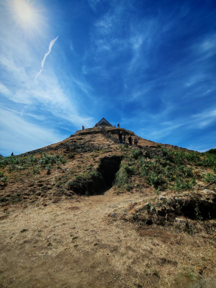
Yet Carnac holds another essential site to visit, just a few kilometers from the alignments in the center of town: the Saint-Michel Tumulus, the largest monumental cairn/mound in continental Europe (measuring 125 meters in length by 10 meters in height).
This site serves as a textbook example of sacred continuity and spatial reuse. Sitting directly atop the Neolithic mound today is the Chapel of Saint-Michel. This Christian structure collapsed and was destroyed twice throughout history, yet was rebuilt in the exact same spot both times.
This phenomenon highlights how succeeding religions deliberately absorbed and incorporated pre-existing sacred sites to assimilate local cults and retain the devotion of existing populations.
The Carnac Museum of Prehistory: Neolithic Treasures
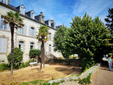
Our stop in Carnac could only conclude in the town center with a visit to the Museum of Prehistory (Musée de Préhistoire). Though intimate in size, the museum houses one of the most significant megalithic collections in the world.
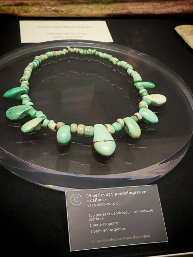
Among the standout artifacts are the Callaïs and Jadeite Axes—exquisitely polished, brilliant green tools whose raw materials originated in the Italian Alps and the Iberian Peninsula, demonstrating the vast trade networks of the Neolithic elite. We also highlight the Castellic and Cerny Style Pottery (finely decorated vessels, including pieces with characteristic grooved patterns, recovered from grave goods in regional tumuli) and the Jewelry (necklaces, pendants, and beads made of variscite and amber) retrieved from within monumental elite tombs such as the Saint-Michel and Mane-er-Hroëk mounds.
After enjoying a delicious gallette, we take a brief pause and begin to gather our thoughts on this fascinating journey through Morbihan.