Beyond Morbihan: Puy du Fou – When History and Reenactment Become a Thrilling Spectacle

When planning a trip—as has become our habit in recent years as the kids grow up—we always look for “support” destinations so we don’t stay too single-minded with the theme of archaeology! But when you realize you are just two hours away from a park like Puy du Fou, you know you’ve hit the jackpot.

Indeed, anyone who, like us, has spent over twenty years visiting megalithic sites, archaeological digs, and museums across Europe knows how difficult it is to make ancient stones “speak” and to bring back the daily life, gestures, and atmosphere of past centuries. Not to mention the challenge of introducing an archaeological site to a child. Kids in particular often find themselves having to imagine what the places we visit used to look like, and we almost always have to rely on plexiglass scale models or rigid educational panels.Then you arrive in Vendée, in the heart of France, and encounter a completely different concept: Puy du Fou.

Calling it a “theme park” would be an understatement. For those who love archaeology and the great eras of the past, Puy du Fou is a true immersive time machine where historical reenactment reaches simply astounding technical and theatrical heights. Before getting into the details, let’s clarify the spirit of the park: across a vast area set in the countryside, there are around 20 stage sets where the same 30-minute show is performed three to five times a day. These shows use real actors (often stunt performers), sweeping musical scores, and incredible stage designs to recreate historical or mythological moments, resulting in an impressive theatrical production. Imagine being inside a real castle or a genuine Roman amphitheater, when suddenly up to fifty actors and various animals begin to tell a story…

Costumes, Details, and Sets: Every History Buff’s Dream

As history enthusiasts and explorers of ancient remains, what immediately strikes you at Puy du Fou is not just the sheer scale of the productions, but the almost obsessive attention to visual detail. Let’s start with the accuracy of the costumes: from the chainmail of the Roman soldiers and gladiators in the Signe du Triomphe arena to the detailed tunics of the Vikings landing from their drakkars, all the way to the horse armor and knightly gear of the Hundred Years’ War (Le Secret de la Lance). The fabrics, leathers, helmets, and accessories never look “plastic”; instead, they convey the weight, texture, and tangible reality of period attire.
The sets are built life-size! Walking through the historical villages recreated inside the park—from the Year 1000 village to the medieval hamlet and the 19th-century town—allows you to observe ancient building techniques, artisan workshops, and atmospheres of times gone by with a level of visual continuity that is exceedingly rare. During the shows, whether showcasing naval maneuvers or hand-to-hand sword duels, the choreography is never a mere excuse for entertainment; it draws heavily from European historical memory and iconography.

A Journey Through the Eras
The true power of this venue lies in its ability to span a vast timeline, allowing you to leap from one era to another in just a few hours. Roman Antiquity is brought to life in a spectacular arena featuring chariot races and gladiatorial combats with a raw visual intensity reminiscent of great cinematic epics. Moving on to the Middle Ages, we find the dramatic attack of Vikings whose longships (drakkar) literally emerge from the water, alongside major medieval battles filled with siege engines and epic cavalry charges. Arriving at the Modern Era and the Great Wars, you can move among 17th-century musketeers before entering the poignant, immersive walkthrough experience inside the World War I trenches in Les Amoureux de Verdun.

Obviously, as travelers and science communicators, we know very well the difference between the academic rigor of a stratigraphical excavation or the solemnity of a thousand-year-old menhir and the theatrical illusion of a stage show. But that is precisely the point: high-level reenactment does not replace archaeology—it feeds it. It provides that breath of life and color that is so often missing from textbooks, helping us visually picture how the past was alive, dynamic, and made of real people. For those who love traveling in the footsteps of ancient history and want to treat themselves to an experience of pure visual wonder, Puy du Fou is a stop that will genuinely surprise you. One piece of advice: plan for at least a two-day ticket so you have enough time to see all the shows or even rewatch a favorite, such as the incredible falconry display that brings Le Bal des Oiseaux Fantômes to life.

Categories: Senza categoria | Tags: , , | Commenti disabilitati su Beyond Morbihan: Puy du Fou – When History and Reenactment Become a Thrilling Spectacle

Journey into Morbihan #4: The Stone Ocean of Carnac

Among the Grandeur of the Menhirs, Recent Geophysical Discoveries, the Saint-Michel Tumulus, and the Museum of Prehistory

At long last… Carnac!
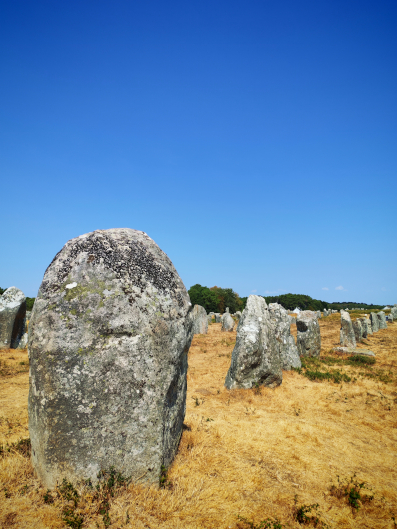
We chose the pleasant town of Vannes as our base, and the 25-minute drive connecting us to the heart of Morbihan is delightful, winding through rolling hills, woodlands, and traditional houses with dark slate roofs. As soon as we arrive in Carnac, we instantly realize why it is considered one of the most iconic monumental landscapes in the world. The sheer scale of the site leaves you breathless: a true stone architecture engineered across kilometers of land!

The Alignments: Anatomy of a Giant

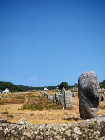
The numbers of Carnac speak for themselves: approximately 2,730 recorded menhirs to date, stretching across roughly 4 kilometers and divided into its famous sectors (Le Ménec, Kermario, Kerlescan, and Le Petit Ménec).
The alignments are not continuous; they are interrupted by three main gaps and appear to follow a precise spatial layout: the stones are arranged in decreasing order, from the tallest (located to the west) to the shortest (toward the east). Immediately before the first group and within these gaps, one notices menhirs positioned out of alignment, forming semi-circular or rectangular structures. Most of the menhirs were quarried directly from the bedrock granite outcroppings upon which they still stand today.

Considering that local granite has a density of 2.7 metric tons per cubic meter, quarrying, lifting, and positioning these blocks required an organized, skilled society driven by a shared vision—further proof that six to seven thousand years ago, this region was inhabited by a population that was not only numerous, but highly specialized and complex.

Upon arriving at the visitor center—a beautiful building featuring a bookshop, a temporary exhibition space, and an elevated first-floor viewing platform to admire the vastness of the first sector—we join a tour with a guide who is as engaging as she is knowledgeable, allowing us to walk right inside the site itself. Up close, the monoliths are striking in both size and placement. Yet, one detail is even more astonishing: while the surface of the stones today is eroded by weathering (with losses of several millimeters in depth), protected or subterranean finds reveal that all the menhirs were originally engraved. Just imagining such a vast expanse of carved stones (perhaps similar to those seen inside Gavrinis) is mind-boggling!

As we walk among these monoliths, our guide points out that several are marked with a small orange dot. The reason? Around a century ago, in 1920, archaeologists re-erected about 20% of the stones found fallen on the ground, placing them according to the prevailing theories of the era. For scientific transparency, these “re-erected” stones were marked with an orange dot or circle, allowing subsequent scholars (and visitors) to distinguish them from those remaining in their original in situ positions.

Beneath the Surface: The Scientific & Geophysical Breakthrough (2026)

While strolling among the blocks, our guide mentioned a cutting-edge geophysical study published in February 2026 in the journal Archaeological Prospection, conducted by a research team led by Guillaume Bruniaux, Vivien Mathé, Olivier Agogué, and Vincent Ard. As soon as we returned to our accommodation, we read it, and we are delighted to share it with you here because, in its methodology and findings, it represents a genuine breakthrough.

The researchers applied an ultra-high-resolution, non-invasive protocol (combining magnetometry, ground-penetrating radar [GPR], and electrical resistivity tomography [ERT]) across the unexcavated terrain between the Kerlescan alignments and the Manio mound. In doing so, they respected the strict excavation limits designed to protect this site, likely in the hope that non-invasive technologies would eventually deliver major scientific advancements.
The mapping unveiled a vast array of subsurface anomalies completely invisible on the ground surface. They identified biches (stone socket pits)—meaning they located the exact underground footprints of hundreds of menhirs removed or destroyed over the centuries! Hundreds… Furthermore, the geophysical data mapped associated charcoal/cooking hearths (cooking pits) and buried structural enclosures. The analysis proves that the Carnac complex was not a series of isolated alignments, but a much denser, interconnected, and continuous landscape than indicated by the standing stones visible today. A spatial continuity that points toward a deliberate, large-scale monumental undertaking.
Link to publication record: ResearchGate Multi‐Method Geophysical Surveys Between and Around the Kerlescan and the Manio Megalithic Alignments in Carnac (DOI: 10.1002/arp.70036)

The Saint-Michel Tumulus and Sacred Stratigraphy

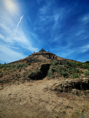
Yet Carnac holds another essential site to visit, just a few kilometers from the alignments in the center of town: the Saint-Michel Tumulus, the largest monumental cairn/mound in continental Europe (measuring 125 meters in length by 10 meters in height).
This site serves as a textbook example of sacred continuity and spatial reuse. Sitting directly atop the Neolithic mound today is the Chapel of Saint-Michel. This Christian structure collapsed and was destroyed twice throughout history, yet was rebuilt in the exact same spot both times.

This phenomenon highlights how succeeding religions deliberately absorbed and incorporated pre-existing sacred sites to assimilate local cults and retain the devotion of existing populations.

The Carnac Museum of Prehistory: Neolithic Treasures

Our stop in Carnac could only conclude in the town center with a visit to the Museum of Prehistory (Musée de Préhistoire). Though intimate in size, the museum houses one of the most significant megalithic collections in the world.

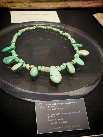
Among the standout artifacts are the Callaïs and Jadeite Axes—exquisitely polished, brilliant green tools whose raw materials originated in the Italian Alps and the Iberian Peninsula, demonstrating the vast trade networks of the Neolithic elite. We also highlight the Castellic and Cerny Style Pottery (finely decorated vessels, including pieces with characteristic grooved patterns, recovered from grave goods in regional tumuli) and the Jewelry (necklaces, pendants, and beads made of variscite and amber) retrieved from within monumental elite tombs such as the Saint-Michel and Mane-er-Hroëk mounds.

After enjoying a delicious gallette, we take a brief pause and begin to gather our thoughts on this fascinating journey through Morbihan.

Categories: Senza categoria | Commenti disabilitati su Journey into Morbihan #4: The Stone Ocean of Carnac

Journey to Morbihan #3: Locmariaquer and Gavrinis

In the megalithic landscape of Morbihan, stones were never static monuments. For roughly three thousand years (between the sixth and third millennia BCE), this region was a living landscape—a sacred theater shaped by successive elites, changing worldviews, evolving architectural styles, and genuine spiritual paradigm shifts. Nothing demonstrates this better than the Locmariaquer complex and the nearby Cairn of Gavrinis: two places separated by water yet united by an extraordinary story of engineering, symbolism, and sacred “recycling.”

Locmariaquer: The Era of Giants and the Great Catastrophe

We began this phase of our exploration on the Locmariaquer peninsula, the nerve center of the first major megalithic era (5th millennium BCE). Here, lying on the ground like a sleeping giant, rests the Grand Menhir Brisé!

Standing 21 meters tall and weighing approximately 300 tons, it is the largest single block of stone ever transported and erected by humans in Neolithic Europe. Carved from a single block of orthogneiss, its quarry of origin was located at least 10 kilometers away. Moving it across the complex geography of the period—keeping in mind that the current gulf did not exist yet, but was rather a plain traversed by three major rivers—required crossing estuaries and sea channels, likely using massive barges or floating platforms crafted by joining dugout canoes together.
The Grand Menhir did not stand alone: it served as the anchor of an alignment of 19 monumental menhirs extending toward the coast, positioned right where the dry land ended and the sea was closest. Around 4300 BCE, this colossal system collapsed. While intentional destruction due to cultural or religious upheavals was long suspected, geological evidence strongly points to a violent earthquake that shattered the giant stele into four pieces.

Within the same archaeological site—accessed through a welcoming visitor center offering an introductory 10-minute film—and adjacent to the Grand Menhir lies the monumental tumulus of Er Grah, an individual passage grave stretching an impressive 140 meters in length. Excavations inside revealed prestige artifacts confirming the presence of a ruling elite connected to long-distance trade networks: among these are exquisite polished jadeite axes originating from the Italian Alps.

The Sacred Puzzle: La Table des Marchands and Gavrinis

When the alignments of the 5th millennium collapsed or lost their original function, subsequent populations did not abandon the monoliths. Instead, they reused them as “sacred raw material” to construct grand passage cairns.
One of the most fascinating cases of reconstructive archaeology in the world involves the massive capstone of the Table des Marchands right here in Locmariaquer and that of Gavrinis.

La Table des Marchands is a funerary complex located just a few meters from the Grand Menhir. Its chamber is roofed by a giant slab of orthogneiss. On its underside, carved reliefs depicting a bovid and an axe-plow are clearly visible—yet truncated. Two other fragments of the same original stone were “relocated” several kilometers away! The second piece, equal in size to the first, was incorporated into the ceiling of the Gavrinis chamber, while a third, smaller fragment was discovered at the Er Vinglé site.

When digital reconstructions aligned the three pieces, they matched perfectly. Originally, they formed a single, titanic carved stele roughly 14 meters high, erected in the Grand Menhir alignment before being felled, broken into three parts, and redistributed across the gulf.
The upper portion of the stele (weighing around 20 tons) was transported across the water to the island of Gavrinis. Archaeologists proved the feasibility of this nautical feat by building and testing double-canoe catamaran replicas capable of floating heavy loads across the gulf’s intense currents. However, experimental archaeology has so far only successfully transported stones weighing around 500 kg—a fraction of the original weight. It remains an open question whether a multi-ton stele could truly be moved using larger canoes!
Now, it is time to set sail: at the port of Larmor-Baden, we board a boat accompanied by a specialized guide. After twenty minutes, we land on the islet of Gavrinis, accessible today only by ticket and carefully preserved for future generations. To be honest: years ago, when we decided to include Morbihan in our travels, it was Gavrinis—alongside Carnac—that convinced us! And our expectations were fully met!

Gavrinis: The Sistine Chapel of the Neolithic

Reached by boat, the island of Gavrinis hosts a cairn whose internal passage offers an almost hypnotic visual experience.
Before going inside, we want to emphasize that, contrary to skeptics who doubt the intentional orientation of these monuments, the axis of the passage at Gavrinis shows a clear East-West alignment, designed to capture sunlight during key astronomical moments of the year.

Examining the structure reveals that one of the passage slabs features engravings of a squid/octopus motif and an axe on its upper side—completely hidden once the stone was placed in position. The presence of carved motifs on hidden surfaces indicates that many slabs were originally part of earlier outdoor alignments, later reused and over-carved with new motifs on the faces visible to visitors.
These engravings were executed outdoors in daylight before the stones were positioned. Traditional stone hammers were insufficient to carve the hard granite; artisans relied on quartz nodules, a material non-native to the site that had to be imported specifically. To cushion the violent recoil and protect their arms, workers bound the quartz to a wooden handle using animal stomach tissue as a shock-absorbing buffer.
The process was painstaking. Using a quartz hammer and a granite axe, an artisan carved at a rate of just 2 centimeters per minute. Completing a single carved slab required about a month of continuous labor, totaling roughly a year and a half to two years to finish the decorative program of the entire tomb.

The Islet of Er Lannic and the Mystery of the Waters

A short distance from Gavrinis rises the islet of Er Lannic, where megalithic history intersects with changing sea levels. The site consists of two overlapping, figure-eight-shaped elliptical stone circles (cromlechs). Today, one circle remains visible on dry land, while the other is completely submerged by the tide.

The stones of the submerged circle (the older of the two) range between 4 and 8 meters in height, whereas those of the more recent terrestrial circle rarely exceed 1.5 meters. This dramatic reduction in scale likely reflects a systemic crisis: the depletion of local resources, rising sea levels, and a potential loss of social cohesion or political centralization.

During underwater and surface surveys, archaeologists recovered over 8 kg of ceramic artifacts and 50 incense burners, testifying to intense ceremonial and votive activity linked to water or ancestor cults.

A Global Sanctuary: The “Valley of the Kings” of the Neolithic

With over 500 cataloged megalithic monuments in the Morbihan area alone, this gulf undoubtedly served as a major spiritual center of Atlantic Europe. The extraordinary concentration of tumuli, cairns, and alignments suggests a supra-regional sacred function: a true sanctuary of the dead, a Neolithic “Valley of the Kings” to which distant populations traveled to erect monuments and bury their dead in the shadow of stone giants.
To us, it feels like this landscape held a sacred magnetism comparable to Valcamonica in Italy. One archaeological theory suggests that the wealth of local “nobles” derived from the salt trade—Morbihan being one of the earliest areas to harvest salt on an industrial scale to preserve food. We like to think that one of the primary “currencies” of trade may have been participation in sacred rites and processions, much like what would occur thousands of years later with the Mystery cults of the Mediterranean.


Now, the time has finally come to head to Carnac! Let’s move!

Categories: Senza categoria | Commenti disabilitati su Journey to Morbihan #3: Locmariaquer and Gavrinis

Journey to Morbihan #2: The Splendor of Breton Megalithism Between Le Petit Mont and Erdeven

After a couple of days traveling—with a pleasant stopover in the Mayenne department—we arrive in the heart of southern Armorica to immerse ourselves in the landscape stretching between the Gulf of Morbihan and the Bay of Quiberon. We have thus arrived at one of the most complex and fascinating megalithic concentrations of European prehistory, recognized in 2025 as a UNESCO World Heritage Site (“The Megaliths of Carnac and of the Shores of Morbihan”).

It was here that two major streams of colonizing farmers met after centuries of moving across a continent increasingly freed from ice. Originating in Mesopotamia and Anatolia, these populations followed two distinct routes: one headed toward northern Europe (eventually reaching Great Britain), while the other followed the northern coast of Africa, crossing Spain and Portugal. Around the 5th millennium BCE, these two migration paths intersected here—where local human groups had already been settled since the 8th millennium BCE—giving rise to a dynamic culture rich in technical knowledge. They shaped the territory with a dense network of dry-stone architecture, passage graves, giant tumuli, and standing stones designed to intertwine ceremonial, territorial, and likely astronomical functions.
The moment we entered southern Brittany, megaliths immediately began popping up along our route, constantly surprising us. Every site is not only clearly signposted (with directions starting right from the national highways) but also impeccably maintained and often staffed—with attendants, guides, and well-stocked bookshops—even when access is completely free!

A prime example is the Tumulus of La Roche aux Fées, the very first site we visited. Tucked away in the countryside along the road from Rennes to Vannes—just past the magical Forest of Brocéliande, legendary home of Merlin the Wizard—La Roche aux Fées was a delightful stop. It is the largest passage tomb (allée couverte) in France, constructed from 40 massive blocks of red schist, some weighing over 40 tons! Its astronomical alignment is clearly oriented toward the sunrise of the winter solstice.

Having reached Brittany, we suggest exploring this vast region through two places that serve as essential pieces of the prehistoric landscape: the Cairn of Petit Mont in Arzon and the monumental sacredness of the Erdeven alignments.

The Cairn of Petit Mont: Evolving Architecture on the Rhuys Peninsula

Perched 36 meters above sea level on the Rhuys Peninsula, the Cairn of Petit Mont dominates the Atlantic coastline and the entrance to the Gulf of Morbihan. Since prehistoric times, it served as a crucial visual landmark for coastal navigation and territorial control. The site is extremely welcoming, featuring a well-stocked bookshop and a visitor center with informational panels alongside a dedicated workshop area for adults and children. If you visit, plan to spend a full day here: you can participate in hands-on workshops or even watch a practical demonstration on how menhirs were transported and erected in antiquity!
The initial construction phase of Petit Mont dates back to around 4600 BCE, beginning as an elongated earthen monument without internal burial chambers. Around 4000 BCE, a monumental dry-stone cairn with a long passage tomb was added beside it. During the Late Neolithic (3000 BCE), the structure was expanded to include two additional dolmen chambers, enclosed by a double stone retaining wall. Occupied through the Bronze and Iron Ages, the cairn was partially destroyed during World War II when the German occupation converted part of the ancient structure into a reinforced concrete military bunker.
The site’s importance lies primarily in its role as a spatial marker for the entire surrounding landscape, but also in the significant artifacts recovered here. These include personal ornaments made of variscite originating from Spain and a serpentine stone necklace from the Treviso region in northern Italy! Such finds provide clear clues that this funereal complex served an elite class with extensive trade connections across Europe, illustrating a vibrant and interconnected Neolithic world. This picture becomes even more intriguing when we expand our view to the princely burials of Locmariaquer or the Carnac alignments. But first, let us cross the Bay of Morbihan and travel from Arzon to Erdeven!

Erdeven and the Kerzerho Alignments: A Truly Sacred Forest!

If you climb to the highest point of Petit Mont (which was meticulously reconstructed following strict archaeological standards after wartime damage), you can admire a vast horizon and spot the peninsula on the opposite side of the narrow strait enclosing the gulf, where the megaliths of Erdeven are located. Six thousand years ago, the Gulf of Morbihan did not exist as it does today; sea levels were different, and three major rivers carved through this coastal zone.

Therefore, to reach the opposite shore today, we had to drive all the way around the gulf!
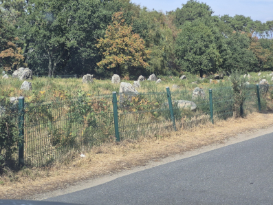
Erdeven represents one of the most spectacular and intricate standing stone complexes in the entire region. While the famous stone rows of Carnac draw most of the crowd, the site of Kerzerho in Erdeven astounds visitors with the sheer majesty of its menhirs and the complex spatial grid woven into the landscape. You can explore this clean and pristine landscape on foot in a truly magical atmosphere along a 10 km walking trail that winds among various megalithic monuments scattered all around you.
The Kerzerho alignments consist of dozens of granite monoliths arranged in parallel rows and circular enclosures surrounded by vegetation. At the edge of the complex stand impressive menhirs that remain upright—some exceeding 6 meters in height—bearing witness to a coordinated engineering and community effort during the Middle Neolithic. Much like the neighboring Carnac rows, the layout at Kerzerho aligns with key axes of the solar and solstitial cycles. These arrangements point toward a sacred landscape, likely experienced through processional avenues and open-air sanctuaries designed for community gatherings and seasonal ceremonies.

Wall Symbology, Astronomical Orientations, and the Cosmos
In our view, the spatial organization of Morbihan’s monuments reveals rigorous geometric and astronomical planning, even if current trends among archaeologists tend to downplay (or even deny) this aspect. This approach left us somewhat amazed, and we will dedicate a specific article in this series to the topic.
In any case, solstitial alignments remain evident—such as the entrances to the Petit Mont dolmens, which maintain a consistent East/South-East orientation referencing the solar cycle and cults of funereal rebirth. Visual networks are another major highlight: the elevated position of the Cairn of Petit Mont ensures direct visibility with the Cairn of Gavrinis and the megalithic enclosure of Er Lannic, integrating the entire Gulf basin into a single visually connected ritual space.

These last two sites will be the main subjects of our next article, where we will also examine ancient carvings that have survived the passage of time—bearing symbols that remain to be fully deciphered.

In the next article (Journey to Morbihan #3), we will move to Locmariaquer to analyze the sheer gigantism of the Grand Menhir Brisé and the extraordinary history of the reused stele shared between the Table des Marchands and Gavrinis.

Categories: Senza categoria | Commenti disabilitati su Journey to Morbihan #2: The Splendor of Breton Megalithism Between Le Petit Mont and Erdeven

Exploring Lutetia, Comfortably by Bus!

Our journey to the land of French megaliths begins! We are taking advantage of this trip to enjoy a few days in the capital, always through the lens of ancient history.

Little remains of ancient Lutetia, the pre-Roman Celtic settlement established by the Gaulish tribe known as the Parisii (from which modern-day Paris takes its name). While some trace the origin of the name to the Latin term lutum, meaning “marsh” or “swamp”—which indeed abounded in the area—we also notice a significant root common to the ancient world. That Lu- prefix strongly evokes Lug-, the shining deity (from which “Lucifer” also later derives), which gave its name to so many ancient locations (think of Lugagnano or Liguria).

The area along the Seine River was likely marshy, but surely no ancient people would choose an unhealthy site to settle permanently. We lean toward a landscape well-suited for human life: when we recall that the earliest settlements were right on the Île-de-France, beneath what is now Notre-Dame, we realize that the island in the middle of the river was truly shining. A hidden Sun.

Julius Caesar conquered Gaul in the 1st century BCE, and the settlement developed into an important Roman center under the name Lutetia Parisiorum. Over time, it gradually took the name of the people who inhabited it, becoming Paris, likely as early as the 4th century CE.

During our few days here, we set out to get our fill of archaeology. From the mandatory stop at the Louvre (we highly recommend the Cycladic and Aegean archaeological collections) to the Musée de l’Homme, where we explored the history of human evolution and reassembled a puzzle we began two years ago in southwestern France.

We are referring to the skull of the Cro-Magnon man, exhibited here but brought to light in 1868 at a rock shelter now known as the Abri de Cro-Magnon, located in Les Eyzies-de-Tayac-Sireuil in the Dordogne department—a site we visited during our journey through Périgord in October 2023.

Cataloged as Cro-Magnon 1 and nicknamed “The Old Man” (Le Vieillard), this fossil provides us with the first tangible evidence of Homo sapiens in Europe. Found accidentally during railway construction, it was part of an intentional burial alongside four other adults and an infant, accompanied by animal teeth and shell ornaments. “The Old Man,” who lived during the Upper Paleolithic about 30,000 years ago, was around 50 years old at death. His dolichocephalic cranial vault, with a cranial capacity of 1,600 cm³ (larger than modern humans!), makes him as modern as he is extraordinary. High-resolution CT scans revealed that the facial bones around the forehead and eye sockets exhibit erosions (skin pitting), indicating he suffered from a genetic condition or severe fungal infection (such as Langerhans cell histiocytosis or neurofibromatosis) that caused benign tumors and destructive tissue lesions on his face.

Equally thrilling at the Musée de l’Homme was observing—among other Paleolithic Venuses on display—the Venus of Lespugue! Standing approximately 15 cm tall, this mammoth ivory statuette was carved roughly 25,000 years ago and remains one of the most extraordinary examples of Upper Paleolithic portable art. It was discovered in 1922 in the Rideaux Cave at Lespugue (Haute-Garonne), at the foot of the Pyrenees. Regrettably, it was accidentally damaged by a pickaxe blow during its excavation by archaeologist René de Saint-Périer.

Later restored in Paris, its pronounced steatopygia makes it one of the most fascinating Venus figurines to survive to the present day. During the Gravettian period, these carved or sculpted Venuses connected people to a natural, feminine deity—abundant and generous, embodying fertility and Mother Earth.

To travel between these museums, we relied on Tootbus, and it was fantastic! The low-emission bus dropped us off at key locations using their hop-on, hop-off service (with 10 strategic stops across the city, from the Champs-Élysées to the Panthéon). Thanks to the open top deck, we enjoyed incredible panoramic views of the entire city. Navigating Paris—a metropolis whose scale can be daunting for anyone wishing to travel frequently, especially families with young children like ours—has never been easier. Combining the bus tour with a cruise along the Seine (also organized by Tootbus), we were able to step into the perspective of the area’s first inhabitants, who undoubtedly navigated these very waters to deliver supplies to the Île-de-France, around which we sailed!

Finally, at the Musée Carnavalet in Paris, several monoxylon canoes (carved from a single tree trunk, such as oak or pine) are preserved. Recovered in 1922 in Bercy (Paris) and dating back to the Neolithic period (between 2700 and 2500 BCE), these ten vessels that once navigated the Seine in the era of Lutetia represent one of the best-preserved collections of prehistoric boats in Europe. Hollowed out using fire and polished stone axes, they could exceed five meters in length. When considering that the Seine was much wider at the time—up to 200 meters across—it becomes clear how essential they were for transporting people and goods.

A fantastic starting point to immerse ourselves in one of the beating hearts of Neolithic Europe: Morbihan awaits us!

Categories: Senza categoria | Commenti disabilitati su Exploring Lutetia, Comfortably by Bus!

Road to Morbihan (and Paris) looking for megaliths!

Megalithism is a building practice that appears to have emerged in Europe around the sixth millennium BCE. Megalithic cultures emerged in Western Europe during the Neolithic period and refers to that phase of human history which, after the last Ice Age, began to reclaim the European grasslands freed from the ice by marking the landscape with huge stones. The main traces of these works have been found in the British Isles, along the Atlantic coasts, and in the Mediterranean. Although several megaliths also appeared inland, this practice left numerous marks along the coastlines or on the hills overlooking them, as if to unite not only the earth with the sky, but likely also the limit that defines a passage between worlds—the sea coast.

For over twenty years we have been traveling to visit megalithic sites: Crete, Malta, Greece, Portugal, Spain, southern Italy, England, Ireland, and Scotland. Soon it will be France’s turn, specifically Morbihan: The Megaliths of Carnac and the shores of Morbihan were officially inscribed as a UNESCO World Heritage Site on July 12, 2025.

Hagar Qim, Malta – Credit: Massimo Frera, 2004

In our view, this recognition is fundamental to reaffirming the memory of what once was: in Europe, the impact of Christianity was devastating when it came to erasing historical memory. After her conversion to Christianity, Flavia Giulia Elena (later Saint Helena- Sant’Elena), mother of Emperor Constantine I, went on a pilgrimage to the Holy Land and ordered the destruction of pagan temples built over sacred sites (such as the Temple of Aphrodite in Jerusalem) to erect the first Christian basilicas. She thus paved the way for a practice that, shortly after under Theodosius I, culminated in the Edict of Thessalonica in 380 CE: Christianity became the official state religion, and, above all, the destruction of pagan temples and sites—including megaliths—was tolerated. This destruction continued until the 12th century as an outright campaign against Paganism. Several menhirs were destroyed, while others were carved with a cross (sometimes with crosses placed on their top) to convert them into Christian sacred sites. A clear example of this can be seen in the vie cave of Maremma.

We should also recall the Council of Arles (452 CE) and the Council of Tours (567 CE), where the Church ordered the faithful and bishops to destroy or hide the stones venerated by pagans. This eventually led to the edict of Charlemagne: in 789 CE, he issued the “Admonitio Generalis”, an edict explicitly ordering the tearing down and removal of menhirs and sacred trees dedicated to pagan worship.

Hill of Tara,
Meath County, Ireland

Credit: Massimo Frera, 2008

Of course, some megalithic material survived in an unusual way, integrated into the walls of houses, churches, and fences. To be fair, this reuse occurred even in the Neolithic period: at the site of Locmariaquer (which we will try to visit), its famous Grand Menhir Brisé (dated to 4300 BCE)—the largest single block of stone ever erected by humans in the Neolithic, measuring 20 meters long and weighing 300 tons—fell and broke into four pieces. Perhaps due to an earthquake, or perhaps an intentional demolition caused by a political or religious change. Still in Morbihan, we have another example of menhir reuse in prehistoric times: some were knocked down to be reused as “capstones” for the burial chambers of later dolmens, as seen in the examples at Gavrinis.

Without delving for now into the construction theories of megalithic monuments, or their symbolic and religious value, let us conclude this short introductory piece by reiterating the importance of the UNESCO recognition granted to France in recent years. France was among the first countries to react to the “modern” destruction of historical monuments when, in 1889, it listed the Carnac Alignments and other major megalithic sites as protected Historical Monuments. Since then, destruction has been illegal and severely punished. Nevertheless, in 2023, an event we consider very serious occurred right in Carnac: an alignment of 39 small menhirs, classified as “secondary,” was removed and flattened to make way for a store construction site!

We will head first to Paris to spend 4 days visiting history, archaeology, and paleontology museums, and finally, we will spend 10 days in Vannes, to visit Morbihan. See you soon!

Tags: , , , , | Commenti disabilitati su Road to Morbihan (and Paris) looking for megaliths!

Ngorongoro, Serengeti, Tarangire

Breathing the Landscape of Human Origins

We have to make a necessary digression from our usual narrative.
As we previously written, travelling to archaeological sites in Africa is not as simple as in Europe. Every logistical aspect becomes part of the research experience: how to reach a site, how to move within it, which areas are truly accessible, opening hours, permits, and sometimes even how to obtain entrance tickets. But when the archaeological landscape coincides with one of the most extraordinary natural environments on Earth, the distinction between heritage and nature disappears.
We spent our three months really close to the crater of Ngorongoro and we had to visit The Ngorongoro Conservation Area, the Serengeti plains, and Tarangire National Park: not only among the most iconic safari destinations in the world, but also part of the environmental framework in which early humans evolved.
Here you do not only observe wildlife. You can breathe the same air that our ancestors breathed.

Ngorongoro crater safari

Ngorongoro Conservation Area: Landscape as Archive

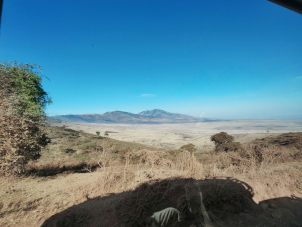
The Ngorongoro Conservation Area represents a unique model of integrated heritage management, where wildlife protection, Maasai pastoral traditions, and archaeological research coexist. After passing by some Maasai Bomas (traditional villages of Maasai people), we could reach Olduvai Gorge, one of the most important palaeoanthropological sites in the world (see our previous post), but also Laetoli, where the fossilised footprints of early hominins testify to the emergence of bipedalism. The volcanic landscape, shaped by tectonic forces linked to the Rift Valley, has preserved ecological conditions that allow us to imagine the environment in which early Homo species lived. Open grasslands, water sources, volcanic soils, migratory animals — the essential components of survival. At those times, human beings probably shaped our brain, and our stream of consciousness, while moving, exploring, fearing. Yes, fear. Fear was probably the main feeling we had at those times. We were prey, mostly to felines. We weren’t at the top of the food chain, not yet.
Access to Ngorongoro requires careful planning. Entrance fees are regulated by the Ngorongoro Conservation Area Authority (NCAA), and vehicles must follow precise routes within protected zones. The balance between conservation and accessibility is delicate, and visitor flows are managed accordingly.
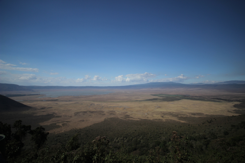
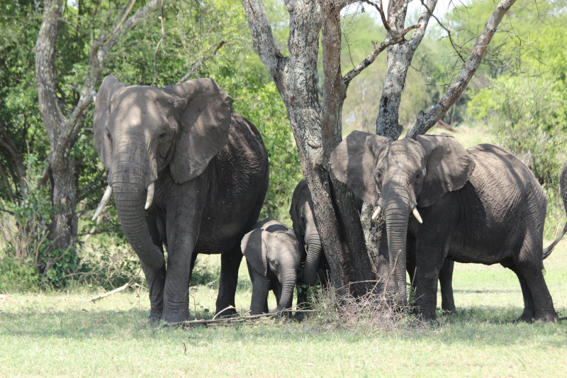
At the bottom of the crater, after descending 600 meters along the crater’s inner slopes, you can encounter wild animals, free to exist and still capable of expressing their dangerousness. It’s a sensation that sinks into you, one that you can only tame because the shell of the jeep you’re travelling in gives you comfort. Your mind reels, however, when a multi-ton elephant is just a few meters away from you and, for some reason, your driver had the engine off.

Serengeti: Predators, Prey, and Evolutionary Pressure

Moving westward, the Serengeti expands into a vast ecosystem where predator-prey relationships unfold on a scale that is difficult to imagine elsewhere.

For palaeoanthropology, such environments are not merely scenic landscapes. They represent evolutionary laboratories.

Early humans did not evolve in isolation but within dynamic ecological networks. Large herbivores, seasonal migrations, competition for water resources, and the presence of predators shaped adaptive strategies, mobility patterns, and technological innovation.

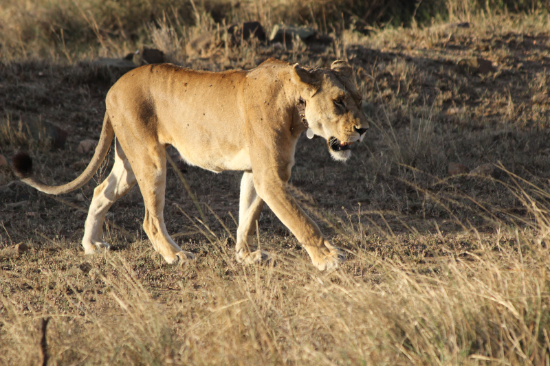
Observing lions resting in the shade or herds of wildebeest moving across the plains is not only an emotional experience. It is also an opportunity to reflect on the environmental pressures that influenced cognitive development, cooperation, and tool-making behaviour.

The Serengeti today preserves elements of this deep ecological continuity.

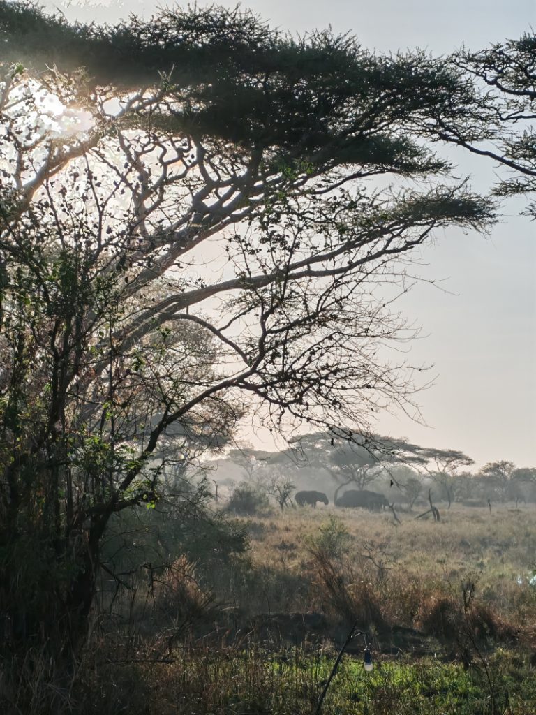
Serengeti in the early morning: an evolutionary landscape of Africa

Entry to Serengeti National Park is regulated through a structured system of permits and entrance fees, with designated gates and controlled access points. The Central Serengeti remains the most accessible sector for travellers based in Karatu -where we settled- or Ngorongoro.
The vastness of the Serengeti, an area equivalent to the Veneto region in northern Italy, makes you feel small. Sleeping inside, camped unprotected, while hyenas and lions make their presence felt at sunset, makes you vulnerable. An experience of scaling back that only gives us a glimpse of the heroism of those times, when our ancestors, despite everything, attempted to move north and east. And so they reached the exit point for the first Out of Africa. How many generations, how many attempts, how much awareness could there have been? Or was it simply a primal survival instinct that only as a species could express itself in an act of heroism?

Tarangire National Park: Water, Seasonality, Adaptation

Tarangire offers a complementary perspective. Here, the Tarangire River becomes the central axis of seasonal survival. During dry months, animals concentrate around water sources, creating patterns of movement that are not unlike those that early humans would have followed.

Elephants, zebras, antelopes, and predators share a fragile ecological balance structured by rainfall cycles.
For those interested in the environmental dimension of human evolution, Tarangire illustrates how water availability influences mobility strategies and territorial behaviour.
The park is accessible through regulated entry gates, and as with Ngorongoro and Serengeti, advance planning is essential.
At Tarangire, named after the river that flows through it, the water element and the surrounding ecosystem, combined with the presence of baobabs, immerse you in an environment that is no longer pure savannah and allows us to imagine the scene that would have presented itself to those who, at the beginning of the hunting season, had to search for suitable hiding places, tracks to track prey, and probably the first deposits of material to build tools useful for survival. In competition, needless to say, with other predators.

For an archaeology-focused journey, visiting these parks may appear secondary.
Yet it is precisely within these environments that early humans developed adaptive strategies that would eventually lead to technological innovation, symbolic behaviour, and social complexity.
Stone tools alone do not tell the full story.
Landscape does.
Wind direction, visibility across plains, availability of prey, presence of predators, seasonal vegetation cycles — all these factors influenced the development of human cognition and cooperation.
Standing in Ngorongoro or watching the horizon of the Serengeti, one senses that archaeology cannot be separated from ecology. These landscapes are not only natural heritage sites. They are anthropological archives.


Safari and human origins Tanzania

Between Nature and Cultural Heritage

Ngorongoro, Serengeti, and Tarangire are not only destinations for wildlife observation. They are part of the broader context of human heritage. Here, environment and culture are inseparable.
And perhaps this is the most powerful lesson of the Rift Valley: human history does not begin with monuments, but with landscapes.
Landscapes that we can still walk today.

Categories: Primatologia | Commenti disabilitati su Ngorongoro, Serengeti, Tarangire

Visiting Olduvai Gorge from Karatu

Three months in Tanzania to explore Karatu and the cultural heritage of the Rift Valley

Reaching the “Cradle of Humankind” is not so simple. Traveling to archaeological sites in Africa is not as easy as in Europe. There are no suburban trains stopping near a gorge that reshaped the history of humanity. No last-minute online ticket booking. No clearly marked pedestrian entrance.
When planning my Olduvai Gorge visit, I quickly understood that logistics are part of the archaeology.
I left Italy convinced I would rent a car and move independently across northern Tanzania. Only once in Karatu did I discover the reality: there are no proper car rental agencies in town. If you want to understand how to visit Olduvai from Karatu, the answer is straightforward — you need to arrange private local transport. A driver. A vehicle used to dust roads. Someone who knows the Ngorongoro Conservation Area procedures.
Karatu is the closest base for visiting Olduvai Gorge. The drive takes approximately 2 hours and a half, depending on road conditions. But distance is not the only variable.

Olduvai lies within the Ngorongoro Conservation Area, meaning that access is regulated. Entry fees are connected to the broader conservation system, and procedures can change. Having a local driver familiar with the process simplifies everything — from permits to navigation across long stretches of unpaved road. We relied to a local travel agency to get entrance and driver permissions. Visiting Olduvai Gorge requires planning: from organizing transport in advance to confirming access conditions, from allowing extra time for checkpoints to bringing water and be prepared for remote conditions.
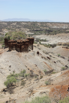
Olduvai is still under investigation. The Department of Anthropology of Rice University (Texas) or the Archaeological and the Paleontological Museum of Madrid run regular fields in this amazing site. As soon as you arrive, you realize that this is not just an archaeology field, but is a living landscape.
One of the most important things to understand before an Olduvai Gorge visit is that it is not a compact monument. It is an extended archaeological and paleo-anthropological complex with multiple areas of interest.
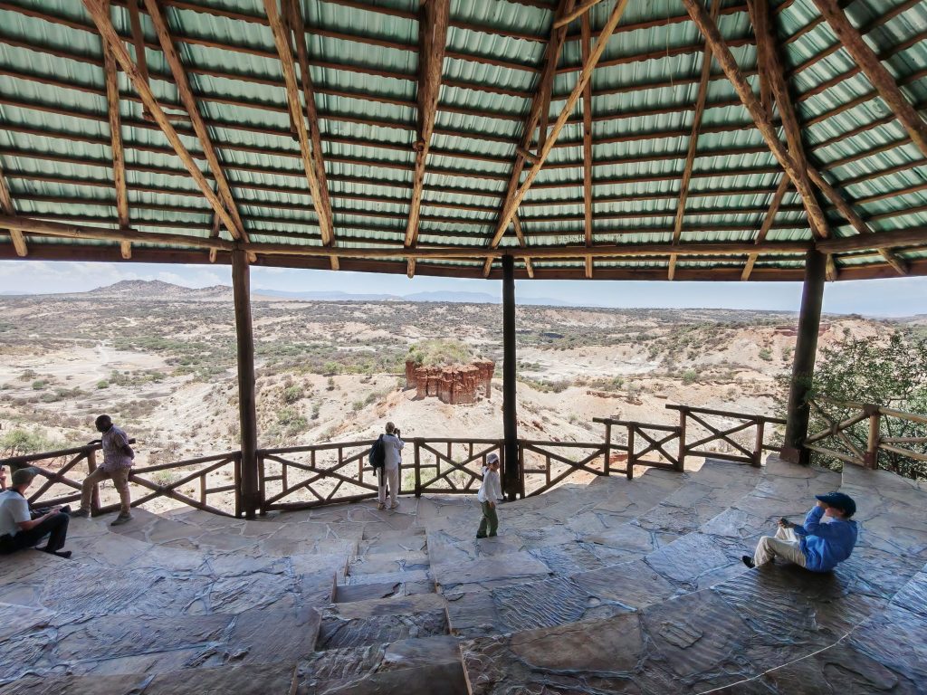
The Gorge and Active Excavations take place in a deep erosion cut exposing stratigraphic layers that preserve nearly two million years of human evolution.
Excavations began in the early twentieth century but became globally renowned through the work of Louis and Mary Leakey. Their discoveries — including early hominin remains and Oldowan stone tools — transformed the scientific understanding of human origins.
Research continues today. Teams still study sediments, faunal remains, and lithic industries. Standing at the rim of the gorge, looking down at the exposed layers, I felt something closer to geological vertigo than touristic admiration. This is time made visible.
Near the gorge stands the Olduvai Museum, rebuilt and expanded in recent years. It occupies the area close to the original research camp used by the Leakeys.
Here you encounter casts of fossils, reconstructions, and explanatory panels that translate complex stratigraphy into human narrative. It is the interpretative heart of the site — where scattered bones and stone tools acquire meaning.
For anyone planning a serious Olduvai Gorge visit, the museum is essential. Without it, the landscape remains silent.

A short drive from the gorge lies one of the most extraordinary archaeological discoveries in Africa: the fossilized footprints at Laetoli. If you want to visit it you have to plan it in advance. Preserved in volcanic ash and dated to approximately 3.6 million years ago, these prints represent the earliest clear evidence of bipedal walking. The original footprints are protected and reburied for conservation, but the site interpretation allows visitors to understand their significance. Seeing where early hominins once walked transforms abstraction into intimacy. You are not looking at tools. You are looking at steps.
Olduvai is not isolated. It exists within a broader protected landscape where wildlife, Maasai pastoral communities, and archaeological heritage coexist.
This overlap deepens the experience. You drive past Maasai settlements. You cross plains shared with zebras and wildebeest. You enter a conservation system where natural and cultural heritage are inseparable. Visiting Olduvai Gorge Tanzania means accepting that archaeology here is embedded in environment, distance, and dust.
Olduvai confronts you with something different. It reminds you that human history did not begin in cities, nor in temples, nor in monumental architecture. It began in landscapes like this. And maybe the red dust on the road from Karatu to Olduvai is part of the lesson — a reminder that archaeology is not only about what we uncover, but about how we approach it.

Categories: Senza categoria | Commenti disabilitati su Visiting Olduvai Gorge from Karatu

Dust, Colors, Memories

Three months in Tanzania to explore Karatu and the cultural heritage of the Rift Valley

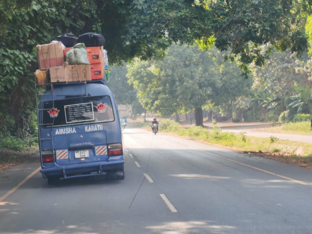
On the road – Photo: Massimo Frera

“Habari!” … “Nzuri!”.
The first words that greet us in Tanzania are not mere pleasantries, but keys to a world where health, community, and collective well-being still lie at the center of life.
Arkeomount begins a new journey — a three-month exploration through the heart of Africa: Tanzania.

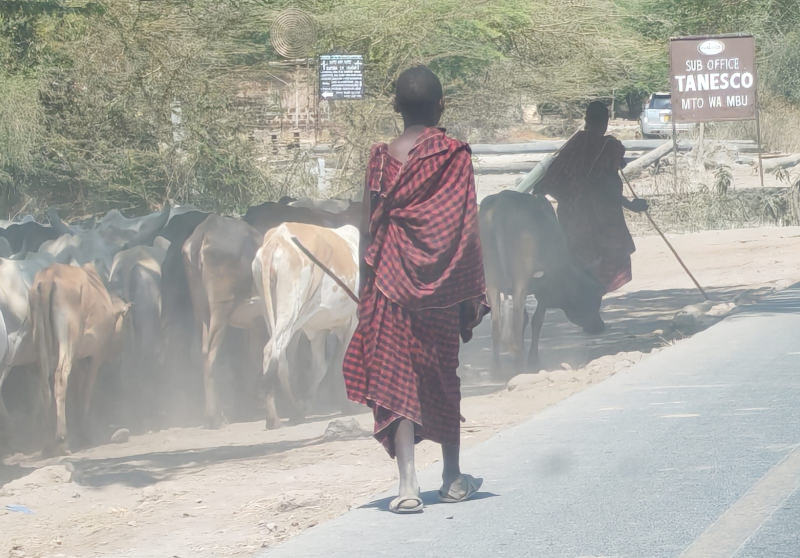
Our path starts in Arusha, at the foot of Mount Kilimanjaro and the Meru volcano, and continues along roads that intertwine with the deep history of the continent. A few kilometers later, the landscape opens up: savannah, scattered shrubs, and the first groups of Maasai herders with their flocks, villages encircled by wooden fences. It feels like walking through a living anthropology textbook, where the ways of dwelling and dressing narrate ancient yet vibrant stories.

The Rift Valley, cradle of humankind, is not only a place of extraordinary geological and archaeological significance — think of Olduvai Gorge, not far from here — but also a cultural crossroads in constant motion, a mosaic of peoples, languages, and traditions.

Take Mto wa Mbu, a town at the intersection of trade and cultural routes, home to representatives of more than 120 of Tanzania’s ethnic groups. The Maasai, easily recognizable in their red shúkà (for men) and purple-toned wraps (for women), are Tanzania’s most iconic people — once warriors, now mostly herders. Yet they are far from the most numerous. The country’s extraordinarily rich and diverse cultural heritage also includes the Sukuma, the largest community, numbering around ten million. They combine agriculture, cattle herding, and ritual dances that recount their origins. On the slopes of Kilimanjaro, the Chagga have prospered thanks to coffee and education, blending Christianity with ancestral traditions. In the southeast, the Makonde carve wood into masks and sculptures — true vessels of spiritual memory. Finally, the Hadza or Hazadabe, the last hunter-gatherers, still live much as their ancestors did thousands of years ago, near the Serengeti — a people we hope to meet during our stay.

Together, these communities reveal that Tanzania’s richness is not only natural and archaeological, but profoundly human — an anthropological heritage that lives on in daily gestures, crafts, and stories passed down through generations, now interwoven with life in both small villages and growing towns.

A Maasai walking with his flock. – Photo: Massimo Frera

Wandering through open-air markets and among street vendors, the bright colors of women’s fabrics blend with the deep red of Maasai cloaks and the equally red dust that covers everything. As we approach Karatu, the landscape changes again: coffee plantations climb toward the plateau, mud and stone houses alternate with small urban details — like a hand-painted sign reading “Queen Salon.” These are not monuments, but fragments of everyday life that become heritage in their own right — testimonies of resilience and creativity.

This intangible heritage renews itself day by day through gestures, habits, and exchanges. And it is precisely this exchange that defines our journey. As anthropologist Bronisław Malinowski once noted, the act of giving is never pure altruism but a way to create bonds and strengthen communities. In this spirit, our arrival — with our medical and journalistic experience, and the energy of our two children who will attend a local school — will intertwine with what we hope to receive in return: knowledge, smiles, and new perspectives.

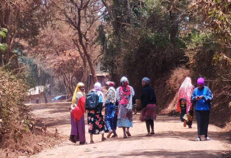
Women walking in Karatu – Photo: Massimo Frera

Karatu is not merely a stop on the way to the Ngorongoro Crater. It is a living laboratory of cultural diversity — a crossroads between past and future — where red dust is not only a natural element but a metaphor: a trace that settles on us, marks us, and reminds us that we are part of a much wider story, one that unites nature, culture, and humanity.

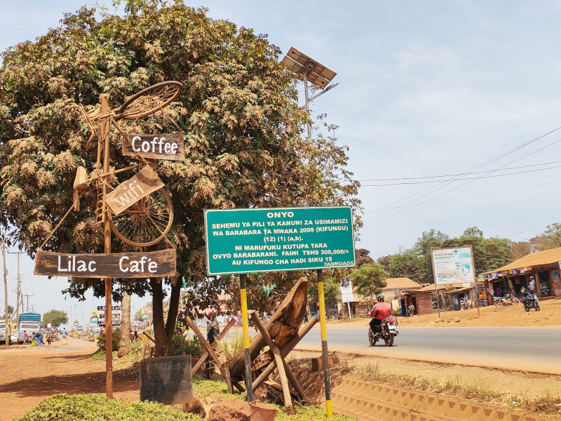
Karatu main road – Photo: Massimo Frera
Categories: Senza categoria | Tags: , , | Commenti disabilitati su Dust, Colors, Memories

Totonaca people, the Hurricane and the Voladores: traditional techniques for controlling an atmospheric phenomena

We have had the fortune of meeting Dr. Luisa Villani, postdoctoral researcher at UNAM, Institute of Anthropology in Mexico City. She is also a professor of cognitive linguistics and anthropology at ENAH, National Anthropological and Historical University.

Luisa Villani – postdoctoral researcher at UNAM, Institute of Anthropology in Mexico City

ArkeoMount (AM): Dr. Villani, You recently stated that the study of the Totonaca people, an indigenous Mesoamerican group primarily residing in the states of Veracruz, Puebla, and Hidalgo, is the project of your life. We are intrigued by your focus on mythical characters associated with atmospheric phenomena, such as Aktziní, linked to the Dance of the Flyers- “Los Voladores”. Could you briefly describe this ritual and explain why you consider it connected to a celebration of hurricanes rather than a solar rite?
Luisa Villani (LV): The relation between the Hurricane and the Flyers’ dance: I started studying the figure of the Hurricane in 2013 when I was writing my PhD thesis. That project was about the meteorological deity of the Hurricane. Among the Totonacs, this supernatural being is named Aktziní. Totonacs told me that this being was an orphan child, who left his home to find a job. He arrived at the house of Thunders, the Pyramid of Nichos in Tajín. The Thunders had and now have the role of watering the Earth with its beneficial rains and to do this, they use some dresses and objects as a sword. One day, when the Thunders left their house to go around the world to make it rain, Aktziní opened a trunk where the most powerful dress was, took it, and dressed with it, and he also grasped the sword. He started to turn in the air in a vortex becoming a hurricane. This twist of Aktziní has made me think about the twists the flyers make around the pole. One day in my fieldwork, I saw a little swirl, rising into the air and this fact made me think about the relation between the wind and the rain. In pre-Colombian culture, Quetzalcoatl among the Aztecs, as Aktziní among Totonacs, is the wind and he has the function to move the drops of rain. So, the Flyers who represent the four winds rise to the pole and then they move and become drops of rain, which come down from the pole and fertilize the Earth. Even if some researchers emphasize the role of the Sun in the Flyers’ dance, I don’t dismiss its role, but I emphasize more an aquatic symbology, and the fact that it is true the presence of the Sun in the dance, not as a star in the universe, but in its role of a cycle reviewer of life, as rain does.
Voladores: copyright Luisa Villani

AM: We understand that this ritual has been documented for at least 450 years and is now recognized as UNESCO’s Intangible Cultural Heritage. How is it experienced today by the local population? What is the actual involvement of the community in preparing for the concluding rite?

LV: The Flyers’ dance is a spectacular dance, and it is the most dangerous ritual dance; therefore, I think that it is for these reasons that it survived for many years in Mexico, from the pre-Columbian period to these days, from the north of Mexico, in the Huasteca region and Totonacapan region, and from Michoacan to the south of Mexico, in Guatemala. It has a symbolism, that these countries share, but every town has developed its own specific symbolism and it depends on different social and physical environments. It is a collective dance; for example, when flyers go to the mountain to cut the tree that will be the pole, the population, specifically men, go with them to help them carry the tree from the mountain to the town. In the meantime, women cook mole with chicken or turkey and receive population and flyers when they come back to town. This dance has changed in the last years because at the moment women also participate in dancing and flying.

Voladores: copyright Luisa Villani

AM: Let’s discuss the aspect of your current research that is engaging you. Could you give our readers an idea of the approach that places neuroscience, linguistics, and cognitive anthropology on an equal footing? Why and how do neurosciences, cognitive linguistics, and cognitive anthropology help analyze and understand this ritual dance better?

LV:

There is a relationship between our thoughts, our individual and collective thoughts, and our movements in the space. We can’t understand the world if we don’t move in the world, because being static, fixed in one place doesn’t let us communicate our ideas. I would say that it does not allow us to think because for cognitive anthropology and cognitive linguistics, thinking is especially something related to acting in the world. Our mental world has a physical base, the brain. One of the most recognized scientists of this time is an Italian scientist, Rizzolatti, who discovered mirror neurons. In our brain, there are these neurons that allow us to reproduce and represent in our mind the gestures and movements of other people. Thanks to these neurons, also in our eyes, and in our muscles, we reproduce and represent the movements of the others, and so it means that we are interacting with each other. In the dance, when dancers move, they are communicating to the audience their ideas and beliefs and also, they are interacting with the public and with their physical environment.


Dr. Villani, thank you so much for your time and availability! We hope to have future occasions to get in touch and share more about your interesting researches in Mexico!

Categories: Senza categoria | Tags: , , , , , , , , | Commenti disabilitati su Totonaca people, the Hurricane and the Voladores: traditional techniques for controlling an atmospheric phenomena