Exploring Lutetia, Comfortably by Bus!

Our journey to the land of French megaliths begins! We are taking advantage of this trip to enjoy a few days in the capital, always through the lens of ancient history.

Little remains of ancient Lutetia, the pre-Roman Celtic settlement established by the Gaulish tribe known as the Parisii (from which modern-day Paris takes its name). While some trace the origin of the name to the Latin term lutum, meaning “marsh” or “swamp”—which indeed abounded in the area—we also notice a significant root common to the ancient world. That Lu- prefix strongly evokes Lug-, the shining deity (from which “Lucifer” also later derives), which gave its name to so many ancient locations (think of Lugagnano or Liguria).

The area along the Seine River was likely marshy, but surely no ancient people would choose an unhealthy site to settle permanently. We lean toward a landscape well-suited for human life: when we recall that the earliest settlements were right on the Île-de-France, beneath what is now Notre-Dame, we realize that the island in the middle of the river was truly shining. A hidden Sun.

Julius Caesar conquered Gaul in the 1st century BCE, and the settlement developed into an important Roman center under the name Lutetia Parisiorum. Over time, it gradually took the name of the people who inhabited it, becoming Paris, likely as early as the 4th century CE.

During our few days here, we set out to get our fill of archaeology. From the mandatory stop at the Louvre (we highly recommend the Cycladic and Aegean archaeological collections) to the Musée de l’Homme, where we explored the history of human evolution and reassembled a puzzle we began two years ago in southwestern France.

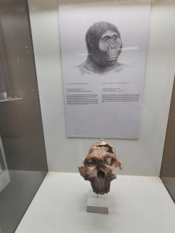
We are referring to the skull of the Cro-Magnon man, exhibited here but brought to light in 1868 at a rock shelter now known as the Abri de Cro-Magnon, located in Les Eyzies-de-Tayac-Sireuil in the Dordogne department—a site we visited during our journey through Périgord in October 2023.

Cataloged as Cro-Magnon 1 and nicknamed “The Old Man” (Le Vieillard), this fossil provides us with the first tangible evidence of Homo sapiens in Europe. Found accidentally during railway construction, it was part of an intentional burial alongside four other adults and an infant, accompanied by animal teeth and shell ornaments. “The Old Man,” who lived during the Upper Paleolithic about 30,000 years ago, was around 50 years old at death. His dolichocephalic cranial vault, with a cranial capacity of 1,600 cm³ (larger than modern humans!), makes him as modern as he is extraordinary. High-resolution CT scans revealed that the facial bones around the forehead and eye sockets exhibit erosions (skin pitting), indicating he suffered from a genetic condition or severe fungal infection (such as Langerhans cell histiocytosis or neurofibromatosis) that caused benign tumors and destructive tissue lesions on his face.

Equally thrilling at the Musée de l’Homme was observing—among other Paleolithic Venuses on display—the Venus of Lespugue! Standing approximately 15 cm tall, this mammoth ivory statuette was carved roughly 25,000 years ago and remains one of the most extraordinary examples of Upper Paleolithic portable art. It was discovered in 1922 in the Rideaux Cave at Lespugue (Haute-Garonne), at the foot of the Pyrenees. Regrettably, it was accidentally damaged by a pickaxe blow during its excavation by archaeologist René de Saint-Périer.

Later restored in Paris, its pronounced steatopygia makes it one of the most fascinating Venus figurines to survive to the present day. During the Gravettian period, these carved or sculpted Venuses connected people to a natural, feminine deity—abundant and generous, embodying fertility and Mother Earth.

To travel between these museums, we relied on Tootbus, and it was fantastic! The low-emission bus dropped us off at key locations using their hop-on, hop-off service (with 10 strategic stops across the city, from the Champs-Élysées to the Panthéon). Thanks to the open top deck, we enjoyed incredible panoramic views of the entire city. Navigating Paris—a metropolis whose scale can be daunting for anyone wishing to travel frequently, especially families with young children like ours—has never been easier. Combining the bus tour with a cruise along the Seine (also organized by Tootbus), we were able to step into the perspective of the area’s first inhabitants, who undoubtedly navigated these very waters to deliver supplies to the Île-de-France, around which we sailed!

Finally, at the Musée Carnavalet in Paris, several monoxylon canoes (carved from a single tree trunk, such as oak or pine) are preserved. Recovered in 1922 in Bercy (Paris) and dating back to the Neolithic period (between 2700 and 2500 BCE), these ten vessels that once navigated the Seine in the era of Lutetia represent one of the best-preserved collections of prehistoric boats in Europe. Hollowed out using fire and polished stone axes, they could exceed five meters in length. When considering that the Seine was much wider at the time—up to 200 meters across—it becomes clear how essential they were for transporting people and goods.

A fantastic starting point to immerse ourselves in one of the beating hearts of Neolithic Europe: Morbihan awaits us!

Categories: Senza categoria | Commenti disabilitati su Exploring Lutetia, Comfortably by Bus!

Road to Morbihan (and Paris) looking for megaliths!

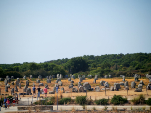
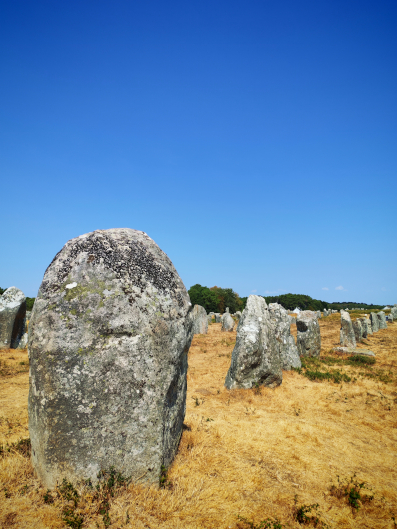
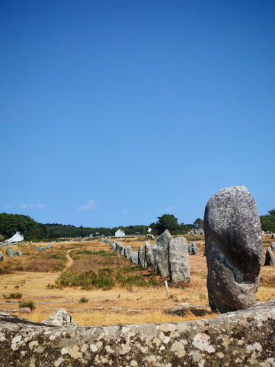
Megalithism is a building practice that appears to have emerged in Europe around the sixth millennium BCE. Megalithic cultures emerged in Western Europe during the Neolithic period and refers to that phase of human history which, after the last Ice Age, began to reclaim the European grasslands freed from the ice by marking the landscape with huge stones. The main traces of these works have been found in the British Isles, along the Atlantic coasts, and in the Mediterranean. Although several megaliths also appeared inland, this practice left numerous marks along the coastlines or on the hills overlooking them, as if to unite not only the earth with the sky, but likely also the limit that defines a passage between worlds—the sea coast.

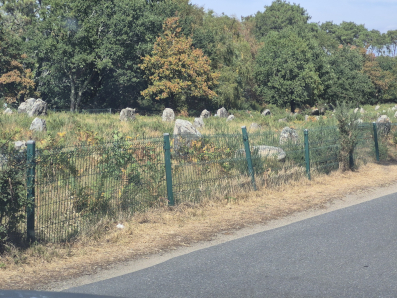
For over twenty years we have been traveling to visit megalithic sites: Crete, Malta, Greece, Portugal, Spain, southern Italy, England, Ireland, and Scotland. Soon it will be France’s turn, specifically Morbihan: The Megaliths of Carnac and the shores of Morbihan were officially inscribed as a UNESCO World Heritage Site on July 12, 2025.

Hagar Qim, Malta – Credit: Massimo Frera, 2004

In our view, this recognition is fundamental to reaffirming the memory of what once was: in Europe, the impact of Christianity was devastating when it came to erasing historical memory. After her conversion to Christianity, Flavia Giulia Elena (later Saint Helena- Sant’Elena), mother of Emperor Constantine I, went on a pilgrimage to the Holy Land and ordered the destruction of pagan temples built over sacred sites (such as the Temple of Aphrodite in Jerusalem) to erect the first Christian basilicas. She thus paved the way for a practice that, shortly after under Theodosius I, culminated in the Edict of Thessalonica in 380 CE: Christianity became the official state religion, and, above all, the destruction of pagan temples and sites—including megaliths—was tolerated. This destruction continued until the 12th century as an outright campaign against Paganism. Several menhirs were destroyed, while others were carved with a cross (sometimes with crosses placed on their top) to convert them into Christian sacred sites. A clear example of this can be seen in the vie cave of Maremma.

We should also recall the Council of Arles (452 CE) and the Council of Tours (567 CE), where the Church ordered the faithful and bishops to destroy or hide the stones venerated by pagans. This eventually led to the edict of Charlemagne: in 789 CE, he issued the “Admonitio Generalis”, an edict explicitly ordering the tearing down and removal of menhirs and sacred trees dedicated to pagan worship.

Hill of Tara,
Meath County, Ireland

Credit: Massimo Frera, 2008

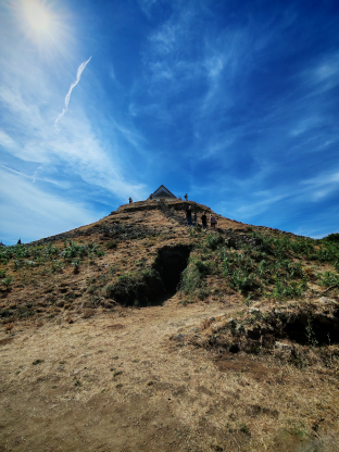
Of course, some megalithic material survived in an unusual way, integrated into the walls of houses, churches, and fences. To be fair, this reuse occurred even in the Neolithic period: at the site of Locmariaquer (which we will try to visit), its famous Grand Menhir Brisé (dated to 4300 BCE)—the largest single block of stone ever erected by humans in the Neolithic, measuring 20 meters long and weighing 300 tons—fell and broke into four pieces. Perhaps due to an earthquake, or perhaps an intentional demolition caused by a political or religious change. Still in Morbihan, we have another example of menhir reuse in prehistoric times: some were knocked down to be reused as “capstones” for the burial chambers of later dolmens, as seen in the examples at Gavrinis.

Without delving for now into the construction theories of megalithic monuments, or their symbolic and religious value, let us conclude this short introductory piece by reiterating the importance of the UNESCO recognition granted to France in recent years. France was among the first countries to react to the “modern” destruction of historical monuments when, in 1889, it listed the Carnac Alignments and other major megalithic sites as protected Historical Monuments. Since then, destruction has been illegal and severely punished. Nevertheless, in 2023, an event we consider very serious occurred right in Carnac: an alignment of 39 small menhirs, classified as “secondary,” was removed and flattened to make way for a store construction site!

We will head first to Paris to spend 4 days visiting history, archaeology, and paleontology museums, and finally, we will spend 10 days in Vannes, to visit Morbihan. See you soon!

Tags: , , , , | Commenti disabilitati su Road to Morbihan (and Paris) looking for megaliths!

Ngorongoro, Serengeti, Tarangire

Breathing the Landscape of Human Origins

We have to make a necessary digression from our usual narrative.
As we previously written, travelling to archaeological sites in Africa is not as simple as in Europe. Every logistical aspect becomes part of the research experience: how to reach a site, how to move within it, which areas are truly accessible, opening hours, permits, and sometimes even how to obtain entrance tickets. But when the archaeological landscape coincides with one of the most extraordinary natural environments on Earth, the distinction between heritage and nature disappears.
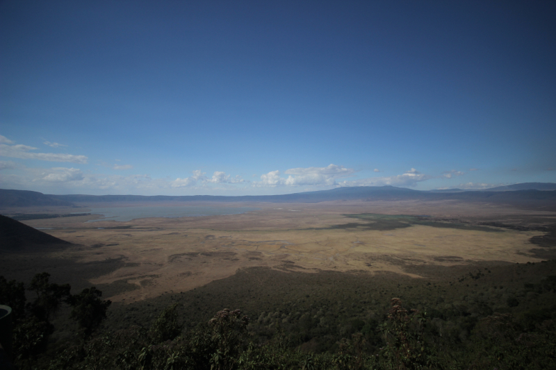
We spent our three months really close to the crater of Ngorongoro and we had to visit The Ngorongoro Conservation Area, the Serengeti plains, and Tarangire National Park: not only among the most iconic safari destinations in the world, but also part of the environmental framework in which early humans evolved.
Here you do not only observe wildlife. You can breathe the same air that our ancestors breathed.

Ngorongoro crater safari

Ngorongoro Conservation Area: Landscape as Archive

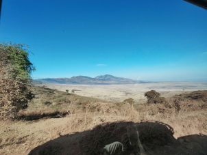
The Ngorongoro Conservation Area represents a unique model of integrated heritage management, where wildlife protection, Maasai pastoral traditions, and archaeological research coexist. After passing by some Maasai Bomas (traditional villages of Maasai people), we could reach Olduvai Gorge, one of the most important palaeoanthropological sites in the world (see our previous post), but also Laetoli, where the fossilised footprints of early hominins testify to the emergence of bipedalism. The volcanic landscape, shaped by tectonic forces linked to the Rift Valley, has preserved ecological conditions that allow us to imagine the environment in which early Homo species lived. Open grasslands, water sources, volcanic soils, migratory animals — the essential components of survival. At those times, human beings probably shaped our brain, and our stream of consciousness, while moving, exploring, fearing. Yes, fear. Fear was probably the main feeling we had at those times. We were prey, mostly to felines. We weren’t at the top of the food chain, not yet.
Access to Ngorongoro requires careful planning. Entrance fees are regulated by the Ngorongoro Conservation Area Authority (NCAA), and vehicles must follow precise routes within protected zones. The balance between conservation and accessibility is delicate, and visitor flows are managed accordingly.
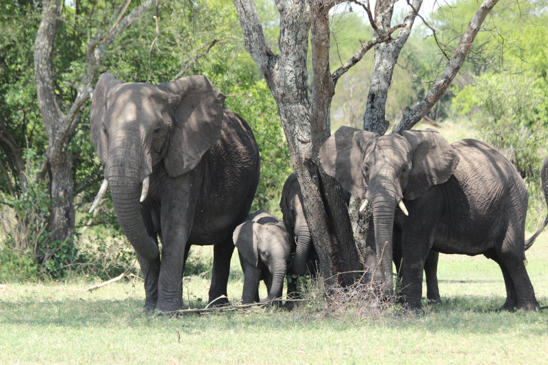
At the bottom of the crater, after descending 600 meters along the crater’s inner slopes, you can encounter wild animals, free to exist and still capable of expressing their dangerousness. It’s a sensation that sinks into you, one that you can only tame because the shell of the jeep you’re travelling in gives you comfort. Your mind reels, however, when a multi-ton elephant is just a few meters away from you and, for some reason, your driver had the engine off.

Serengeti: Predators, Prey, and Evolutionary Pressure

Moving westward, the Serengeti expands into a vast ecosystem where predator-prey relationships unfold on a scale that is difficult to imagine elsewhere.

For palaeoanthropology, such environments are not merely scenic landscapes. They represent evolutionary laboratories.

Early humans did not evolve in isolation but within dynamic ecological networks. Large herbivores, seasonal migrations, competition for water resources, and the presence of predators shaped adaptive strategies, mobility patterns, and technological innovation.

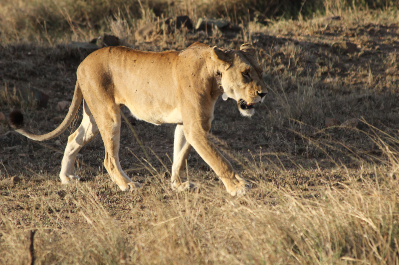
Observing lions resting in the shade or herds of wildebeest moving across the plains is not only an emotional experience. It is also an opportunity to reflect on the environmental pressures that influenced cognitive development, cooperation, and tool-making behaviour.

The Serengeti today preserves elements of this deep ecological continuity.

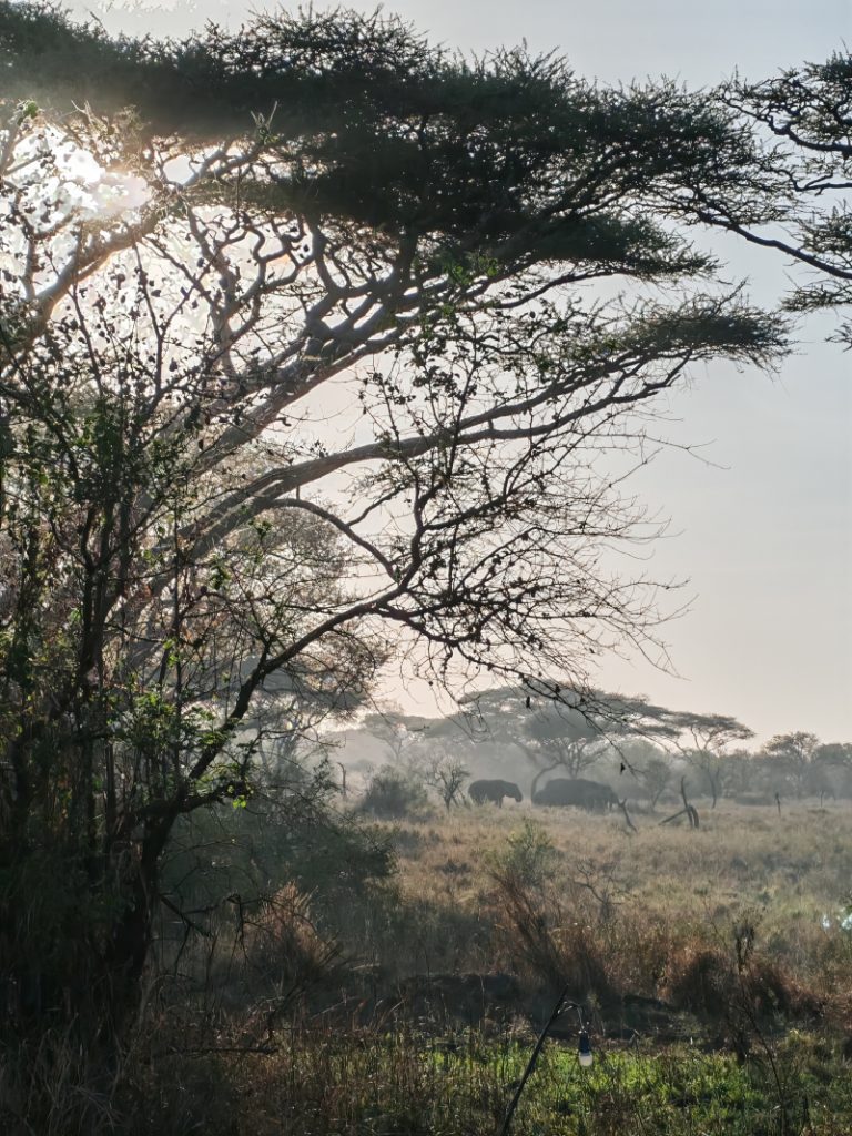
Serengeti in the early morning: an evolutionary landscape of Africa

Entry to Serengeti National Park is regulated through a structured system of permits and entrance fees, with designated gates and controlled access points. The Central Serengeti remains the most accessible sector for travellers based in Karatu -where we settled- or Ngorongoro.
The vastness of the Serengeti, an area equivalent to the Veneto region in northern Italy, makes you feel small. Sleeping inside, camped unprotected, while hyenas and lions make their presence felt at sunset, makes you vulnerable. An experience of scaling back that only gives us a glimpse of the heroism of those times, when our ancestors, despite everything, attempted to move north and east. And so they reached the exit point for the first Out of Africa. How many generations, how many attempts, how much awareness could there have been? Or was it simply a primal survival instinct that only as a species could express itself in an act of heroism?

Tarangire National Park: Water, Seasonality, Adaptation

Tarangire offers a complementary perspective. Here, the Tarangire River becomes the central axis of seasonal survival. During dry months, animals concentrate around water sources, creating patterns of movement that are not unlike those that early humans would have followed.

Elephants, zebras, antelopes, and predators share a fragile ecological balance structured by rainfall cycles.
For those interested in the environmental dimension of human evolution, Tarangire illustrates how water availability influences mobility strategies and territorial behaviour.
The park is accessible through regulated entry gates, and as with Ngorongoro and Serengeti, advance planning is essential.
At Tarangire, named after the river that flows through it, the water element and the surrounding ecosystem, combined with the presence of baobabs, immerse you in an environment that is no longer pure savannah and allows us to imagine the scene that would have presented itself to those who, at the beginning of the hunting season, had to search for suitable hiding places, tracks to track prey, and probably the first deposits of material to build tools useful for survival. In competition, needless to say, with other predators.

For an archaeology-focused journey, visiting these parks may appear secondary.
Yet it is precisely within these environments that early humans developed adaptive strategies that would eventually lead to technological innovation, symbolic behaviour, and social complexity.
Stone tools alone do not tell the full story.
Landscape does.
Wind direction, visibility across plains, availability of prey, presence of predators, seasonal vegetation cycles — all these factors influenced the development of human cognition and cooperation.
Standing in Ngorongoro or watching the horizon of the Serengeti, one senses that archaeology cannot be separated from ecology. These landscapes are not only natural heritage sites. They are anthropological archives.


Safari and human origins Tanzania

Between Nature and Cultural Heritage

Ngorongoro, Serengeti, and Tarangire are not only destinations for wildlife observation. They are part of the broader context of human heritage. Here, environment and culture are inseparable.
And perhaps this is the most powerful lesson of the Rift Valley: human history does not begin with monuments, but with landscapes.
Landscapes that we can still walk today.

Categories: Primatologia | Commenti disabilitati su Ngorongoro, Serengeti, Tarangire

Visiting Olduvai Gorge from Karatu

Three months in Tanzania to explore Karatu and the cultural heritage of the Rift Valley

Reaching the “Cradle of Humankind” is not so simple. Traveling to archaeological sites in Africa is not as easy as in Europe. There are no suburban trains stopping near a gorge that reshaped the history of humanity. No last-minute online ticket booking. No clearly marked pedestrian entrance.
When planning my Olduvai Gorge visit, I quickly understood that logistics are part of the archaeology.
I left Italy convinced I would rent a car and move independently across northern Tanzania. Only once in Karatu did I discover the reality: there are no proper car rental agencies in town. If you want to understand how to visit Olduvai from Karatu, the answer is straightforward — you need to arrange private local transport. A driver. A vehicle used to dust roads. Someone who knows the Ngorongoro Conservation Area procedures.
Karatu is the closest base for visiting Olduvai Gorge. The drive takes approximately 2 hours and a half, depending on road conditions. But distance is not the only variable.

Olduvai lies within the Ngorongoro Conservation Area, meaning that access is regulated. Entry fees are connected to the broader conservation system, and procedures can change. Having a local driver familiar with the process simplifies everything — from permits to navigation across long stretches of unpaved road. We relied to a local travel agency to get entrance and driver permissions. Visiting Olduvai Gorge requires planning: from organizing transport in advance to confirming access conditions, from allowing extra time for checkpoints to bringing water and be prepared for remote conditions.
Olduvai is still under investigation. The Department of Anthropology of Rice University (Texas) or the Archaeological and the Paleontological Museum of Madrid run regular fields in this amazing site. As soon as you arrive, you realize that this is not just an archaeology field, but is a living landscape.
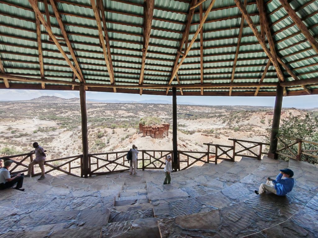
One of the most important things to understand before an Olduvai Gorge visit is that it is not a compact monument. It is an extended archaeological and paleo-anthropological complex with multiple areas of interest.
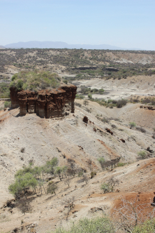
The Gorge and Active Excavations take place in a deep erosion cut exposing stratigraphic layers that preserve nearly two million years of human evolution.
Excavations began in the early twentieth century but became globally renowned through the work of Louis and Mary Leakey. Their discoveries — including early hominin remains and Oldowan stone tools — transformed the scientific understanding of human origins.
Research continues today. Teams still study sediments, faunal remains, and lithic industries. Standing at the rim of the gorge, looking down at the exposed layers, I felt something closer to geological vertigo than touristic admiration. This is time made visible.
Near the gorge stands the Olduvai Museum, rebuilt and expanded in recent years. It occupies the area close to the original research camp used by the Leakeys.
Here you encounter casts of fossils, reconstructions, and explanatory panels that translate complex stratigraphy into human narrative. It is the interpretative heart of the site — where scattered bones and stone tools acquire meaning.
For anyone planning a serious Olduvai Gorge visit, the museum is essential. Without it, the landscape remains silent.

A short drive from the gorge lies one of the most extraordinary archaeological discoveries in Africa: the fossilized footprints at Laetoli. If you want to visit it you have to plan it in advance. Preserved in volcanic ash and dated to approximately 3.6 million years ago, these prints represent the earliest clear evidence of bipedal walking. The original footprints are protected and reburied for conservation, but the site interpretation allows visitors to understand their significance. Seeing where early hominins once walked transforms abstraction into intimacy. You are not looking at tools. You are looking at steps.
Olduvai is not isolated. It exists within a broader protected landscape where wildlife, Maasai pastoral communities, and archaeological heritage coexist.
This overlap deepens the experience. You drive past Maasai settlements. You cross plains shared with zebras and wildebeest. You enter a conservation system where natural and cultural heritage are inseparable. Visiting Olduvai Gorge Tanzania means accepting that archaeology here is embedded in environment, distance, and dust.
Olduvai confronts you with something different. It reminds you that human history did not begin in cities, nor in temples, nor in monumental architecture. It began in landscapes like this. And maybe the red dust on the road from Karatu to Olduvai is part of the lesson — a reminder that archaeology is not only about what we uncover, but about how we approach it.

Categories: Senza categoria | Commenti disabilitati su Visiting Olduvai Gorge from Karatu

Dust, Colors, Memories

Three months in Tanzania to explore Karatu and the cultural heritage of the Rift Valley

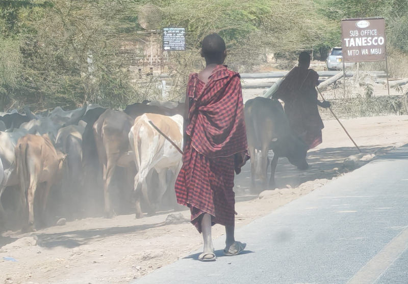
On the road – Photo: Massimo Frera

“Habari!” … “Nzuri!”.
The first words that greet us in Tanzania are not mere pleasantries, but keys to a world where health, community, and collective well-being still lie at the center of life.
Arkeomount begins a new journey — a three-month exploration through the heart of Africa: Tanzania.

Our path starts in Arusha, at the foot of Mount Kilimanjaro and the Meru volcano, and continues along roads that intertwine with the deep history of the continent. A few kilometers later, the landscape opens up: savannah, scattered shrubs, and the first groups of Maasai herders with their flocks, villages encircled by wooden fences. It feels like walking through a living anthropology textbook, where the ways of dwelling and dressing narrate ancient yet vibrant stories.

The Rift Valley, cradle of humankind, is not only a place of extraordinary geological and archaeological significance — think of Olduvai Gorge, not far from here — but also a cultural crossroads in constant motion, a mosaic of peoples, languages, and traditions.

Take Mto wa Mbu, a town at the intersection of trade and cultural routes, home to representatives of more than 120 of Tanzania’s ethnic groups. The Maasai, easily recognizable in their red shúkà (for men) and purple-toned wraps (for women), are Tanzania’s most iconic people — once warriors, now mostly herders. Yet they are far from the most numerous. The country’s extraordinarily rich and diverse cultural heritage also includes the Sukuma, the largest community, numbering around ten million. They combine agriculture, cattle herding, and ritual dances that recount their origins. On the slopes of Kilimanjaro, the Chagga have prospered thanks to coffee and education, blending Christianity with ancestral traditions. In the southeast, the Makonde carve wood into masks and sculptures — true vessels of spiritual memory. Finally, the Hadza or Hazadabe, the last hunter-gatherers, still live much as their ancestors did thousands of years ago, near the Serengeti — a people we hope to meet during our stay.

Together, these communities reveal that Tanzania’s richness is not only natural and archaeological, but profoundly human — an anthropological heritage that lives on in daily gestures, crafts, and stories passed down through generations, now interwoven with life in both small villages and growing towns.

A Maasai walking with his flock. – Photo: Massimo Frera

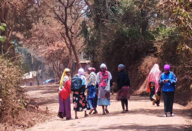
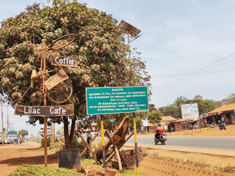
Wandering through open-air markets and among street vendors, the bright colors of women’s fabrics blend with the deep red of Maasai cloaks and the equally red dust that covers everything. As we approach Karatu, the landscape changes again: coffee plantations climb toward the plateau, mud and stone houses alternate with small urban details — like a hand-painted sign reading “Queen Salon.” These are not monuments, but fragments of everyday life that become heritage in their own right — testimonies of resilience and creativity.

This intangible heritage renews itself day by day through gestures, habits, and exchanges. And it is precisely this exchange that defines our journey. As anthropologist Bronisław Malinowski once noted, the act of giving is never pure altruism but a way to create bonds and strengthen communities. In this spirit, our arrival — with our medical and journalistic experience, and the energy of our two children who will attend a local school — will intertwine with what we hope to receive in return: knowledge, smiles, and new perspectives.

Women walking in Karatu – Photo: Massimo Frera

Karatu is not merely a stop on the way to the Ngorongoro Crater. It is a living laboratory of cultural diversity — a crossroads between past and future — where red dust is not only a natural element but a metaphor: a trace that settles on us, marks us, and reminds us that we are part of a much wider story, one that unites nature, culture, and humanity.

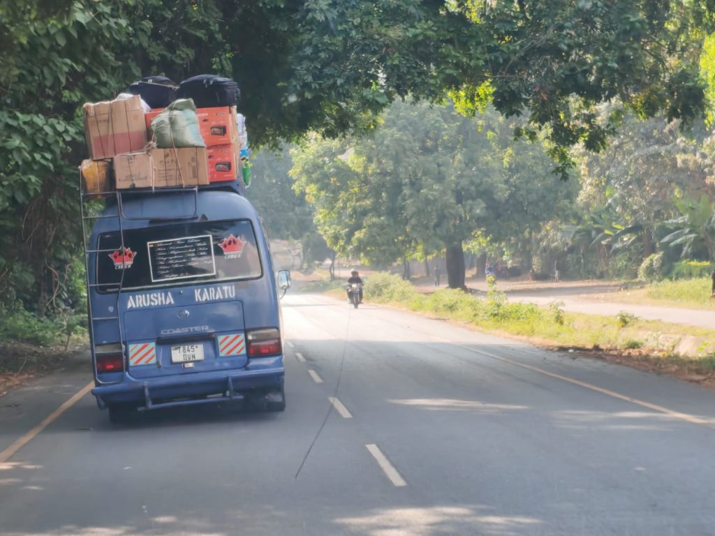
Karatu main road – Photo: Massimo Frera
Categories: Senza categoria | Tags: , , | Commenti disabilitati su Dust, Colors, Memories

Totonaca people, the Hurricane and the Voladores: traditional techniques for controlling an atmospheric phenomena

We have had the fortune of meeting Dr. Luisa Villani, postdoctoral researcher at UNAM, Institute of Anthropology in Mexico City. She is also a professor of cognitive linguistics and anthropology at ENAH, National Anthropological and Historical University.

Luisa Villani – postdoctoral researcher at UNAM, Institute of Anthropology in Mexico City

ArkeoMount (AM): Dr. Villani, You recently stated that the study of the Totonaca people, an indigenous Mesoamerican group primarily residing in the states of Veracruz, Puebla, and Hidalgo, is the project of your life. We are intrigued by your focus on mythical characters associated with atmospheric phenomena, such as Aktziní, linked to the Dance of the Flyers- “Los Voladores”. Could you briefly describe this ritual and explain why you consider it connected to a celebration of hurricanes rather than a solar rite?
Luisa Villani (LV): The relation between the Hurricane and the Flyers’ dance: I started studying the figure of the Hurricane in 2013 when I was writing my PhD thesis. That project was about the meteorological deity of the Hurricane. Among the Totonacs, this supernatural being is named Aktziní. Totonacs told me that this being was an orphan child, who left his home to find a job. He arrived at the house of Thunders, the Pyramid of Nichos in Tajín. The Thunders had and now have the role of watering the Earth with its beneficial rains and to do this, they use some dresses and objects as a sword. One day, when the Thunders left their house to go around the world to make it rain, Aktziní opened a trunk where the most powerful dress was, took it, and dressed with it, and he also grasped the sword. He started to turn in the air in a vortex becoming a hurricane. This twist of Aktziní has made me think about the twists the flyers make around the pole. One day in my fieldwork, I saw a little swirl, rising into the air and this fact made me think about the relation between the wind and the rain. In pre-Colombian culture, Quetzalcoatl among the Aztecs, as Aktziní among Totonacs, is the wind and he has the function to move the drops of rain. So, the Flyers who represent the four winds rise to the pole and then they move and become drops of rain, which come down from the pole and fertilize the Earth. Even if some researchers emphasize the role of the Sun in the Flyers’ dance, I don’t dismiss its role, but I emphasize more an aquatic symbology, and the fact that it is true the presence of the Sun in the dance, not as a star in the universe, but in its role of a cycle reviewer of life, as rain does.
Voladores: copyright Luisa Villani

AM: We understand that this ritual has been documented for at least 450 years and is now recognized as UNESCO’s Intangible Cultural Heritage. How is it experienced today by the local population? What is the actual involvement of the community in preparing for the concluding rite?

LV: The Flyers’ dance is a spectacular dance, and it is the most dangerous ritual dance; therefore, I think that it is for these reasons that it survived for many years in Mexico, from the pre-Columbian period to these days, from the north of Mexico, in the Huasteca region and Totonacapan region, and from Michoacan to the south of Mexico, in Guatemala. It has a symbolism, that these countries share, but every town has developed its own specific symbolism and it depends on different social and physical environments. It is a collective dance; for example, when flyers go to the mountain to cut the tree that will be the pole, the population, specifically men, go with them to help them carry the tree from the mountain to the town. In the meantime, women cook mole with chicken or turkey and receive population and flyers when they come back to town. This dance has changed in the last years because at the moment women also participate in dancing and flying.

Voladores: copyright Luisa Villani

AM: Let’s discuss the aspect of your current research that is engaging you. Could you give our readers an idea of the approach that places neuroscience, linguistics, and cognitive anthropology on an equal footing? Why and how do neurosciences, cognitive linguistics, and cognitive anthropology help analyze and understand this ritual dance better?

LV:

There is a relationship between our thoughts, our individual and collective thoughts, and our movements in the space. We can’t understand the world if we don’t move in the world, because being static, fixed in one place doesn’t let us communicate our ideas. I would say that it does not allow us to think because for cognitive anthropology and cognitive linguistics, thinking is especially something related to acting in the world. Our mental world has a physical base, the brain. One of the most recognized scientists of this time is an Italian scientist, Rizzolatti, who discovered mirror neurons. In our brain, there are these neurons that allow us to reproduce and represent in our mind the gestures and movements of other people. Thanks to these neurons, also in our eyes, and in our muscles, we reproduce and represent the movements of the others, and so it means that we are interacting with each other. In the dance, when dancers move, they are communicating to the audience their ideas and beliefs and also, they are interacting with the public and with their physical environment.


Dr. Villani, thank you so much for your time and availability! We hope to have future occasions to get in touch and share more about your interesting researches in Mexico!

Categories: Senza categoria | Tags: , , , , , , , , | Commenti disabilitati su Totonaca people, the Hurricane and the Voladores: traditional techniques for controlling an atmospheric phenomena

Qhapaq Ñan: Ongoing Reactivation Projects

It has been almost a decade since UNESCO declared the Qhapaq Ñan, also known as the “Andean Road System (Inca Trail),” a World Heritage Site.

Spanning over 30,000 kilometers of pathways with branches across six South American countries (Argentina, Bolivia, Chile, Colombia, Ecuador, and Peru), the Qhapaq Ñan is a unique road network created by the Incas, based on pre-Incan structures. Stretching from the coast to altitudes of up to 6,000 meters, the Qhapaq Ñan represents an incredible communication project that is not only studied today but, we like to believe, being “reactivated”.

Projects like the one near Portrero de Payogasta, close to Salta (Argentina), serve as prime examples of archaeological conservation and enhancement.

Potrero de Payogasta is a hillside site in the Calchaquí valleys, to the right of the Potrero River. From this vantage point, a wide area was visually monitored, and the Inca Trail connected Tastil to Payogasta, to the extent that archaeologists consider it a “small Cuzco in the Calchaquí Valleys.” This open settlement, covering 10 hectares and lacking any protective measures, became the focus of a consolidation and enhancement project led by INAPL (Instituto Nacional de Antropología y Pensamiento Latinoamericano).

We extend our gratitude to the project’s director, archaeologist Christian Vitry (Director Gral. de Preservación e Investigación – Salta. Profesor – Investigador de la UNSa Consultor EIA Arqueológico y Patrimonial), for allowing us to share the video embedded in this post on our channels.

The project involves various levels and, since the beginning, engages the local population and their technical expertise, valuing them as a primary asset. Traditional knowledge, which is nearly ancestral, plays a central role. It is not only reflected in the technology and materials used (identical to those employed by the Incas and sourced from the region) but also encompasses the human, social, and spiritual aspects.

The individuals involved are local residents who have shared their knowledge, practices, and personal stories. The outcome, therefore, goes beyond mere structural preservation and cannot be reduced to tourism and heritage promotion. Here, we encounter the inherent capacity within archaeological heritage to embody the seed for a new paradigm in which the archaeological asset not only channels and centers the spirit of a place but also revitalizes the spirit of those who inhabit it, distributing daily energy and awareness to its residents.

Portrero de Payogasta has been “reactivated.

Categories: Senza categoria | Commenti disabilitati su Qhapaq Ñan: Ongoing Reactivation Projects

Viaggio nel Vézère #5- Il parco Thot, ovvero come avvicinare in maniera efficace i bambini alla preistoria

Thot Park - Laboratorio di pittura parietale per bambini
Thot Park – Laboratorio di pittura parietale per bambini

Cosa piace ai bambini? Giocare.
E poi? Vedere gli animali.
Infine? Toccare con mano.
E allora perché non usare tutti questi elementi e metterli in un solo posto, magari all’aperto, per attirarli a scoprire ciò che è accaduto 20mila anni fa?
Et voilà! Ecco gli ingredienti per il Parco Thot (The Thoth Park, 24290 Thonac, a cinque minuti da Montignac/Lascaux), a due passi da Lascaux. Un parco destinato ai bambini ma molto interessante anche per gli adulti. Se la regione offre molti (ma molti!) parchi a tema per istruire i più piccoli sui temi della preistoria, la particolarità del parco Thot è che qui non ci sono “diorami” (ovvero pupazzi a grandezza naturale), ma esseri in carne ed ossa, ovvero gli animali che qui vivenano nell’Era Glaciale, ovviamente tutti quelli sopravvissuti o i loro discendenti: lupi, bisonti, renne, daini…
E poi un’area per laboratori di pittura parietale, abilmente ricostruita in un sotterraneo, che ricorda in tutto e per tutto una grotta, come quelle viste insieme nei giorni prima. Colori naturali, attrezzi ricostruiti ed ecco che i piccoli rivivono ciò che gli artisti di 20milla anni fa vissero. Possono anche loro dipingere un cavallo di Lascaux, o una Mammuth di Rouffignac! Giocano, toccando con mano.
E poi fuori, a dar da mangiare agli animali insieme al loro “keeper”. E altri spazi-laboratorio all’aperto, per insegnare le tecniche di modellazione delle pietre, o quelle di taglio e cucito che scandivano le giornate dei Cro Magnon.
Un’esperienza unica che in Italia fatichiamo a riconoscere in proposte simili. O sbagliamo?

Thot Park - l'area destinata agli erbivori
Thot Park – l’area destinata agli erbivori
Thot Park - i successori dei bisonti preistorici!
Thot Park – i successori dei bisonti preistorici!
Categories: Senza categoria | Tags: , , , , , , , , , , | Commenti disabilitati su Viaggio nel Vézère #5- Il parco Thot, ovvero come avvicinare in maniera efficace i bambini alla preistoria

Viaggio nel Perigord #4- I ripari rocciosi

Abri du Cap-Blanc, évocation de la sépulture découverte au Cap-Blanc pendant les fouilles.
© Olivier Huard / Centre des monuments nationaux 2023
Reconstitution de la sépulture découverte en 1911, aujourd'hui conservée au Field Museum de Chicago
Abri du Cap-Blanc, évocation de la sépulture découverte au Cap-Blanc pendant les fouilles.
© Olivier Huard / Centre des monuments nationaux 2023
Reconstitution de la sépulture découverte en 1911, aujourd’hui conservée au Field Museum de Chicago.

Sfatato il mito che vivessero nelle grotte, appurato che il clima era rigido (piena Era Glaciale), ci si può chiedere se – a parte villaggi con tende riparate con pelli animali – i nostri predecessori usassero comunque a loro vantaggio le caratteristiche del territorio.
La risposta ci viene fornita dai ripari rocciosi che abbondano nella valle del Vézère inquanto circa 3 milioni di anni fa il mare si ritirò da queste terre (lasciando “solo” il fiume) e facendolo ha eroso uno strato morbido della geologia locale, creando lunghe falesie. Parliamo di impressionanti pareti rocciose che corrono lungo il fiume e che ospitano al loro interno una nicchia aperta, talvolta lunga centinaia di metri, che il Cro Magnon abitò e che anche i nostri avi più recenti, circa dieci secoli fa, tornarono ad abitare per difendersi dalle invasioni vichinghe e norrene.
Abbiamo potuto visitare solo di sfuggita l’Abri du Cro Magnon, famoso per il ritrovamento del primo Sapiens europeo, ma con più calma l’Abri du Cap Blanc (Centre des monuments nationaux – Sites préhistoriques de la vallée de la Vézère – 4 avenue des Grottes – 24620 Les Eyzies – France // Abri du Cap-Blanc – 24620 Marquay – France // Open all year, except on Saturdays and January 1, May 1 and December 25 // https://www.sites-les-eyzies.fr/). Nonostante sia “abri” non è alla luce del sole, ma protetto da una sorta di costruzione oggi anche museo che ne impedisce il deterioramento per motivi atmosferici.

Si tratta di un riparo di circa 13 metri che guarda a nord e che sulla sua parete ospita uno dei più grandi capolavori della scultura monumentale preistorica magdaleniana. Il fregio scolpito, e datato circa 15.000 anni fa, riunisce cavalli, bisonti e cervi, talvolta sovrapposti, altre volte alternati. Proprio ai piedi del cavallo che domina il fregio, è stata ritrovata l’unica sepoltura locale. Le ossa, datate anch’esse al 15,000 BP, sono di una giovane donna di 30 anni, forse di alto rango.
Nel corso della nostra visita, mentre la guida ci faceva notare che una ricerca in PhD di dieci anni fa ha suggerito che il fregio inizialmente rappresentasse bisonti, poi “sostituiti” da cavalli, abbiamo potuto ascoltare un’altra teoria. La trovate descritta nel video.
Come questo rifugio preistorico, classificato patrimonio dell’umanità dall’UNESCO dal 1979, è possibile visitare in zona l’Abri du Poisson, oltre che il sito di Cro Magnon, l’Abri de la Madeleine o le diverse falesie, come quella – maestosa e ricca di storia medievale – della rocca di Saint Cristophe.

Categories: Senza categoria | Commenti disabilitati su Viaggio nel Perigord #4- I ripari rocciosi

Viaggio nel Perigord #3- Lascaux

Lascaux IV © Dan Courtice - Sunset
Ingresso di Lascaux IV ©Dan Courtice – Sunset

Saltiamo i convenevoli, o limitiamoli al massimo: Lascaux è la grotta ornata preistorica più famosa e importante al mondo, al pari di Altamira (Spagna). Scoperta per caso il 12 settembre 1940 da 4 ragazzi che inseguivano il loro cane, la grotta colpisce da subito l’Abate Henri Breuil – grande studioso dell’epoca, primo cattedratico di arte paleolitica di sempre all’Università di Tolosa, e di fatto “barone” di questi studi – per la sua ricchezza artistica e di significato.
Potremmo parlarvi dei colori (qui sono stati usati manganese, ocra rossa e gialla, ma anche loro combinazioni che portano a riconoscere 9 diverse tonalità), o della precisione degli animali, o della grandiosità dell’opera (perché si tratta di un’opera unica, non di un insieme casuale, questo appare abbastanza evidente), ma preferiamo parlarvi di cosa ci ha lasciato, trasmesso.
Ancora un’ultima nota: non siamo potuti entrare nella grotta originale, che è chiusa per motivi di conservazione dagli anni Ottanta, ma nella seconda sua replica – Lascaux IV (Lascaux II e è poche centinaia di metri, Lascaux III è una mostra itinerante) – aperta al pubblico nel dicembre 2016, insieme al Centre International de l’Art Pariétal. Un museo di oltre 8.500 m2 di superficie espositiva, che include una replica completa della grotta e sei gallerie che ripercorrono la storia della sua scoperta, il suo posto nella l’arte rupestre mondiale e la sua interpretazione contemporanea.
Abbiamo scelto una Prestige Visite che dura circa due ore, con guida, e con la sola luce di due piccole torce (elettriche ma in grado di replicare il tremolio di una luce di candela).

Lascaux IV – intérieur CIAP Montignac Lascaux – © Dan Courtice

Diciamo subito che entrare in una grotta “autentica” è un’altra cosa. Percepiamo che l’atmosfera è ricostruita (nonostante i tredici gradi interni!) e pur lodando la capacità artistica di creare una magnifica replica, rimane una replica.
Ma dopo pochi minuti dall’ingresso, le immagini sovrastano la voce che ci diceva continuamente nella nostra testa “beh, non è la vera grotta!”! Forse perché le scene che iniziano a svelarsi, la loro grandiosità, perfezione e intrinseca forze, stavano iniziando a scavarci dentro.
Con Lascaux, non solo la grotta diventa animale, ovvero gli animali si rivelano grazie alla grotta / erano già nella grotta (e dunque la grotta offre solo una superficie che consente di entrare in contatto con un mondo altrimenti velato, ma che è lì, basta toccarlo e avere gli occhi giusti per entrarvi), ma siamo noi che percorriamo una grotta interiore. E nonostante il gruppo sia notevole (saremo state 40 persone quando di solito nelle grotte – quelle vere! – non si entra in più di 10/15), accade che ti trovi ad essere “dentro”.
La prima scena è un vorticare sul soffitto di animali: bisonti e cavalli. E tutti paiono ruotare e danzare. E puntare verso dei cervi. Uno dei punti di questo cerchio vede solo cervi, che sono “guardati” da bisonti e cavalli. Chi sono i cervi?..

Lascaux IV - Lascaux en famille ©Manu Allicot
Lascaux IV – Lascaux en famille ©Manu Allicot

Si apre la prima galleria: animali a destra e sinistra. Ma i cavalli, sempre più spesso, invece di guardare verso il fondo della grotta (avanzando con noi), iniziano ad essere voltati indietro e sono sempre più rappresentati sulla parete sinistra. Il rosso, il nero, il giallo e anche alcuni segni danno grandiosità al percorso. Percorso che, dopo qualche decina di metri, svolta improvvisamente a destra con un angolo acuto. Ma prima di girare, notiamo un sifone verticale aprirsi davanti a noi, e l’unico cavallo capovolto di tutto il Perigord, domina la scena di una sorta di “caduta di cavalli”. Cosa rappresenta?
Giriamo l’angolo, dunque, e quello che ricordiamo è ancora una galleria di bisonti e cavalli, ma sulla destra, dopo qualche passo, dei gradini portano a un piano sollevato da terra di circa 1,5 metri. Sono scale “sacre” ovvero non per umani: il primo scalino è alto, circa uno stacco di 1 metro, poi i successivi scalini sono “umani” di circa 30 cm. Conosciamo altre “scale” sacre come queste, incontrate in altri siti preistorici o del mondo antico, come nella Maremma Toscana: pare che vogliano marcare un passaggio non percorribile da un essere umano, o almeno non da un umano che non sia “sacro”, capace di travalicare le leggi naturali. La guida ci dice che quel ripiano, che diventa un vero e proprio antro sulla destra del percorso, era come l’abside di una chiesa, una sorta di palco cerimoniale. E sul suo fondo, non visitabile (mi sono chiesto come mai visto che è una replica..), l’unica raffigurazione umana: un uomo steso a terra, come abbattuto da un bisonte in fronte a lui Morte sciamanica?

Lascaux 4 ©Manu Allicot_

Lasciamo la “chiesa” e avanzando, sulla sinistra cavalli che “tornano verso l’ingresso”, dipinti dietro (sono sempre dietro) ai bisonti, che avanzano Ma sulla destra tornano i cervi. Sono cervi dipinti solo dal collo in su, come se stessero nuotando. Ci ricordano i miti di rinascita, le divinità alpine e celtiche (Kernunnos) che rappresentano lo sciamano (o l’iniziato dallo sciamano) che grazie alla sua nuova capcità di morire, può rinascere e, affrontando le acque della vita (lo Stige? Mnemosine?), giunge alla scena finale, he si trova nell’ultimo antro della galleria e raffigura l’unico predatore di tutta la grotta: il leone.
Solo l’iniziato può affrontare il re degli animali?
Nel video proviamo a trasmettere ciò che abbiamo qui provato ad abbozzare. Chiariamo che è una nostra percezione, una nostra lettura di un sito che non smette mai di stupire.

Categories: Senza categoria | Commenti disabilitati su Viaggio nel Perigord #3- Lascaux